place

Carroll Gardens Historic District

1986 establishments in New York CityBrooklyn Registered Historic Place stubsCarroll Gardens, BrooklynHistoric districts on the National Register of Historic Places in BrooklynItalianate architecture in New York City
NRHP infobox with nocatNational Register of Historic Places in BrooklynNew York City Designated Landmarks in BrooklynNew York City designated historic districts
Carroll Gardens Clin4 gardens jeh

The Carroll Gardens Historic District is a small municipal and national historic district located in the Carroll Gardens neighborhood of Brooklyn, New York City. The national district consists of 134 contributing residential rowhouses built between the 1860s and 1880s. They are two- and three-story brownstone buildings in the neo-Grec and late Italianate styles located in a rectangle bounded by Carroll, President, Smith, and Hoyt Streets. They feature uniform setbacks, even cornice lines and stoop levels, and fenced front yards and landscaped gardens. These were the result of surveyor Richard Butt, who in 1846 planned gardens in front of the brownstone houses in the oldest section of the neighborhood. The homes are set farther back from the street than is common in Brooklyn, and the large gardens became an iconic depiction of the neighborhood. All the houses in the district, which is afforded a degree of privacy by the street pattern that discourages through traffic on Carroll and President Streets, were built between 1869 and 1884.The district was designated a New York City landmark by the New York City Landmarks Preservation Commission in 1973, and was listed on the National Register of Historic Places in 1983.

Excerpt from the Wikipedia article Carroll Gardens Historic District (License: CC BY-SA 3.0, Authors, Images).

Carroll Gardens Historic District
President Street, New York Brooklyn

Geographical coordinates (GPS) Address Nearby Places
placeShow on map

Wikipedia: Carroll Gardens Historic DistrictContinue reading on Wikipedia

Geographical coordinates (GPS)

Latitude Longitude
N 40.679722222222 ° E -73.990277777778 °
placeShow on map

Address

President Street 399
11231 New York, Brooklyn
New York, United States
mapOpen on Google Maps

Carroll Gardens Clin4 gardens jeh
Share experience

Nearby Places

New York and Long Island Coignet Stone Company Building

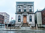
The Coignet Stone Company Building (also the Pippen Building) is a historical structure in the Gowanus neighborhood of Brooklyn in New York City, at the intersection of Third Street and Third Avenue. Designed by architects William Field and Son and constructed between 1872 and 1873, it is the city's oldest remaining concrete building. The Coignet Building is the last remaining structure of a five-acre concrete factory complex built for the Coignet Agglomerate Company along the Gowanus Canal. The building has a two-story cast-stone facade above a raised basement. The Coignet Building was created using a type of concrete patented by Frenchman François Coignet in the 1850s and manufactured at the Gowanus factory. The Coignet Agglomerate Company, for which the building was erected, was the first United States firm to manufacture Coignet stone. Despite the popularity of Coignet stone at the time of the building's construction, the Coignet Agglomerate Company completely shuttered in 1882. The building was subsequently used by the Brooklyn Improvement Company for seventy-five years until that company, too, closed in 1957. The facade was renovated in the 1960s, but the rest of the building was left to deteriorate for the rest of the 20th century. After Whole Foods Market bought the surrounding factory complex in 2005, the Coignet Building became a New York City designated landmark on June 27, 2006. In conjunction with the construction of the adjacent Whole Foods store, the building was restored between 2014 and 2016.