place

High Bridge Reformed Church

19th-century Reformed Church in America church buildingsChurches completed in 1870Churches in Hunterdon County, New JerseyChurches on the National Register of Historic Places in New JerseyHigh Bridge, New Jersey
National Register of Historic Places in Hunterdon County, New JerseyNew Jersey Register of Historic PlacesNew Jersey Registered Historic Place stubsNew Jersey church stubsReformed Church in America churches in New JerseyUse mdy dates from August 2023
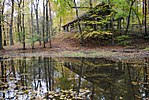
Reformed Church, High Bridge, NJ

High Bridge Reformed Church is a historic church located at Church Street and County Route 513 in High Bridge in Hunterdon County, New Jersey. The church, built in 1870, is part of the Reformed Church in America. It was added to the National Register of Historic Places on November 21, 1980, for its significance in architecture and religion.

Excerpt from the Wikipedia article High Bridge Reformed Church (License: CC BY-SA 3.0, Authors, Images).

High Bridge Reformed Church
Fairview Avenue,

Geographical coordinates (GPS) Address Nearby Places
placeShow on map

Wikipedia: High Bridge Reformed ChurchContinue reading on Wikipedia

Geographical coordinates (GPS)

Latitude Longitude
N 40.670277777778 ° E -74.894722222222 °
placeShow on map

Address

Fairview Avenue 5
08829
New Jersey, United States
mapOpen on Google Maps

Reformed Church, High Bridge, NJ
Share experience

Nearby Places

Readingsburg, New Jersey

Readingsburg, also known as Stone Mill, is an unincorporated community located along the South Branch Raritan River within Clinton Township in Hunterdon County, New Jersey.The community is centered at County Route 639 at the intersection of Raritan River Road and Cokesbury Road, and is located 3.6 miles (5.8 km) northeast of Spruce Run Reservoir and 4.5 miles (7.2 km) east-southeast of Hampton.Readingsburg is located in New Jersey's Highlands geographical province, in northern Hunterdon County at the mouth of the Ken Lockwood Gorge in the narrow, heavily wooded valley cut by the south branch of the Raritan River through the first hills rising above the Piedmont lowlands. The small hamlet hugs the east bank of the south branch at the intersection of a road crossing the river with another following its east bank. A water power site first utilized in the second quarter of the 19th century provided the nucleus for the settlement which consists of several houses clustered around the cross roads as well as mill sites up and down stream from the bridge and two houses on the west bag of the river. The community is surrounded mostly by Woodland with scattered dwellings. The town of Highbridge is located about 1 mile south of Readingsburg; the village of Cokesbury lies several miles to the east. The hamlet of Readingsburg, also called Stone Mill, is the site of 18th and 19th Century watered powered mills. According to a previous State Historical marker, since removed, it was placed on the State Register of historic sites in 1999. Previous owners and operators of the Mill lived in the stone house located at 2 Stone Mill Road, Annandale NJ 98801. The building located at 450 Cokesbury Road was the General Store.