place

Dalkeith, Western Australia

Suburbs in the City of NedlandsSuburbs of Perth, Western AustraliaUse Australian English from March 2014
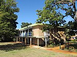
Kylemore gnangarra 01

Dalkeith is an affluent suburb of Perth, Western Australia within the City of Nedlands. The suburb is surrounded on three sides by the Swan River.

Excerpt from the Wikipedia article Dalkeith, Western Australia (License: CC BY-SA 3.0, Authors, Images).

Dalkeith, Western Australia
Circe Circle South,

Geographical coordinates (GPS) Address Nearby Places
placeShow on map

Wikipedia: Dalkeith, Western AustraliaContinue reading on Wikipedia

Geographical coordinates (GPS)

Latitude Longitude
N -31.997 ° E 115.797 °
placeShow on map

Address

Circe Circle South

Circe Circle South
6009 , Dalkeith
Western Australia, Australia
mapOpen on Google Maps

Kylemore gnangarra 01
Share experience

Nearby Places

Dalkeith Hot Pool

Dalkeith Hot Pool was an open air hot spring in Dalkeith, Western Australia. It was situated on the foreshore of the Swan River near Sunset Heritage Precinct at the foot of the escarpment.The hot spring was created in 1922 with the bursting of the casing of a pipe that was part of a nearly 500-metre-deep (1,600 ft) artesian well reaching into the Yarragadee Aquifer. This well had been drilled in 1908 on the Dalkeith foreshore to provide water, as mains water was not available at the time. After the pipe burst, locals built the Dalkeith Hot Pool by enclosing the escaping hot water with limestone walls.During the Second World War the Dalkeith Hot Pool was moved into a concrete pool that had been built for the US Navy based in Nedlands. This concrete pool was situated further east along the foreshore, adjacent to the site on which Tawarri Reception Centre was later built in 1957 between Sunset Foreshore and Beaton Park. During this time, Dalkeith Hot Pool was used exclusively by the US Navy for rest and recuperation (R&R).Dalkeith Hot Pool was infamous for nude – and "nearly nude" – bathing as early as 1935, and those caught by police were taken to court and fined. The pool was eventually closed in 1953, and then filled in around the time of the construction of the Dome (which would become the Tawarri Reception Centre) adjacent to Dalkeith Hot Pool. In 1962 the artesian well was plugged, and the concrete pool was apparently "removed by the Nedlands Council in the early 1990s to facilitate landscaping in the vicinity."

Point Walter
Point Walter

Point Walter (Noongar: Dyoondalup) is a point on the Swan River, Western Australia, notable for its large sandbar that extends into the river. It is located on the southern shore of Melville Water, and forms its western end. Point Walter is located in the suburb of Bicton, approximately 12 kilometres (7 mi) south of the Perth central business district, and 7 kilometres (4 mi) north-east of Fremantle, and is on the opposite side of the river to the suburbs of Mosman Park, Peppermint Grove, and Dalkeith. Point Walter is a site of Aboriginal Australian heritage, both for its place in the Dreamtime and because of the local Whadjuk people's historical activities at the site. Named in 1827 by James Stirling, it was popular among the public for its variety of recreational activities and its facilities, such as tea rooms, a bathing house and a tavern. Through a series of events, the point suffered a drop in patronage from the late 19th century to World War II. At that time, it was rehabilitated from a state of disrepair, and an army camp was built on the premises, which was later transformed into a migrant settlement camp. Since the migrant camp's closure in 1972, the facilities have been used for multiple activities. Since 1912 Point Walter has been run by Melville City Council, and today is contained in the Point Walter Reserve. The reserve and the sandbar serve as important sites for flora and fauna, particularly bird-life. It is popularly used for a variety of recreational activities, and currently hosts the annual Point Walter concert.