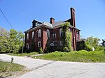
Lowell-Dracut-Tyngsboro State Forest
1910 establishments in MassachusettsMassachusetts state forestsParks in Lowell, MassachusettsParks in Middlesex County, MassachusettsProtected areas established in 1910
Lowell-Dracut-Tyngsboro State Forest is a publicly owned forest with recreational features measuring 1,109 acres (449 ha) that overlap the City of Lowell, and the towns of Dracut and Tyngsborough, Massachusetts. The forest, which includes some 180 acres (73 ha) of ponds, swamps and wetlands, is maintained by the Massachusetts Department of Conservation and Recreation.
Excerpt from the Wikipedia article Lowell-Dracut-Tyngsboro State Forest (License: CC BY-SA 3.0, Authors).Lowell-Dracut-Tyngsboro State Forest
Totman Road,
Geographical coordinates (GPS) Address Website External links Nearby Places Show on map
Geographical coordinates (GPS)
| Latitude | Longitude |
|---|---|
| N 42.663055555556 ° | E -71.3675 ° |
Address
Lowell Dracut Tyngsborough State Forest
Totman Road
01854
Massachusetts, United States
Open on Google Maps


