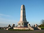
Risedale
Use British English from January 2019Wards of Barrow-in-Furness

Risedale is a ward of Barrow-in-Furness, Cumbria, England. It is bordered by Barrow town centre, Parkside, Newbarns and Roose and had a population of 5,663 in 2001,increasing to 6,294 at the 2011 Census.Risedale is a fairly deprived district, with figures for unemployment being higher than Barrow and national average. Council housing makes up much of the southern area of the ward (in the form of Broadway, Gateway, Longway and Westway).
Excerpt from the Wikipedia article Risedale (License: CC BY-SA 3.0, Authors, Images).Risedale
Abbots Vale,
Geographical coordinates (GPS) Address Nearby Places Show on map
Geographical coordinates (GPS)
| Latitude | Longitude |
|---|---|
| N 54.113 ° | E -3.206 ° |
Address
Newdale/Abbots Vale Community Centre (Artificial) Crown Green Bowls Club
Abbots Vale
LA13 9NZ , Salthouse
England, United Kingdom
Open on Google Maps


