Central Barrow

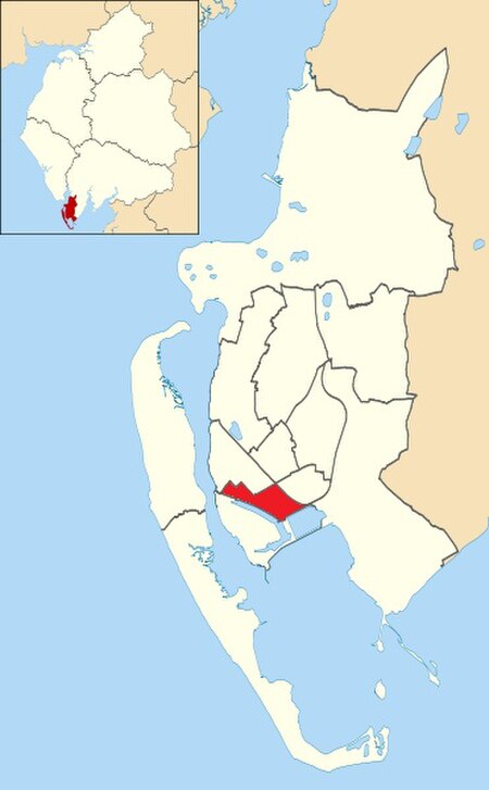
Central Barrow refers both to the town centre of Barrow-in-Furness, Cumbria, England and to the electoral ward that roughly covers the eastern part of that town centre. In 2001 5,584 (ranking 5th out of 13) lived in the Central ward. The population density was 55.96 per hectare, which was well above the local average of 9.24, and England average, 3.77. The population of Central ward had reduced to 4,583 at the 2011 Census. Central Barrow is amongst the 3% most deprived areas in the country and households have an average weekly income around £100 lower than the region's average, however the area being the central business district of the town is also home to many of Barrow's retail outlets, as well as a large amount of offices, restaurants and governmental buildings. Part of the £200 million Waterfront Barrow-in-Furness project is being constructed in the southern part of Central Barrow (including the new Marina Village). In a bid to tackle issues related with Central Barrow such as deprivation, unemployment and poor housing quality/choice, Barrow Borough Council is currently preparing the 'Central Barrow Masterplan' which will set out guidelines for the redevelopment of Central Barrow. The plan will also put forward proposals for a bus station/transport interchange to replace the existing shelters outside of the town hall. It is not yet known when the plan will be published or what exactly it will include.
Excerpt from the Wikipedia article Central Barrow (License: CC BY-SA 3.0, Authors, Images).Central Barrow
Hope Street,
Geographical coordinates (GPS) Address Nearby Places Show on map
Geographical coordinates (GPS)
| Latitude | Longitude |
|---|---|
| N 54.11 ° | E -3.22 ° |
Address
Hope Street
Hope Street
LA14 1LS , Barrow Island
England, United Kingdom
Open on Google Maps


