Streatham South (ward)
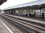
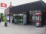
Streatham South ward is an administrative division of the London Borough of Lambeth, United Kingdom. It is the most southerly ward of the borough and has borders with Croydon, Merton, and Wandsworth. The population of the ward at the 2011 Census was 14,336. The ward includes the neighbourhoods of: Streatham Vale (south-west of Streatham Common railway station); Lower Streatham (west of Streatham High Road and south of Greyhound Lane); Streatham Lodge Estate conservation area (east of Streatham High Road and south of the Streatham Common open space).Streatham South ward is located in the Streatham constituency of the UK House of Commons, the Lambeth and Southwark constituency of the London Assembly, and was in the London constituency of the European Parliament.
Excerpt from the Wikipedia article Streatham South (ward) (License: CC BY-SA 3.0, Authors).Streatham South (ward)
Rama Close, London Streatham (London Borough of Lambeth)
Geographical coordinates (GPS) Address Nearby Places Show on map
Geographical coordinates (GPS)
| Latitude | Longitude |
|---|---|
| N 51.415 ° | E -0.131 ° |
Address
Rama Close
Rama Close
SW16 5DW London, Streatham (London Borough of Lambeth)
England, United Kingdom
Open on Google Maps


