place

Helpringham

Civil parishes in LincolnshireNorth Kesteven DistrictUse British English from February 2014Villages in Lincolnshire
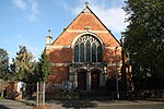
High Street, Helpringham geograph.org.uk 182846

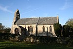
Helpringham is a village and civil parish in the North Kesteven district of Lincolnshire, England. It lies on the edge of the Fens, and 5 miles (8 km) southeast of Sleaford. It is noted for its Grade I listed St Andrew's Church.

Excerpt from the Wikipedia article Helpringham (License: CC BY-SA 3.0, Authors, Images).

Helpringham
Vicarage Lane, North Kesteven Helpringham

Geographical coordinates (GPS) Address Nearby Places
placeShow on map

Wikipedia: HelpringhamContinue reading on Wikipedia

Geographical coordinates (GPS)

Latitude Longitude
N 52.95453 ° E -0.30504 °
placeShow on map

Address

Helpringham STW

Vicarage Lane
NG34 0RP North Kesteven, Helpringham
England, United Kingdom
mapOpen on Google Maps

High Street, Helpringham geograph.org.uk 182846
Share experience

Nearby Places

Burton Pedwardine
Burton Pedwardine

Burton Pedwardine is a hamlet and civil parish in the district of North Kesteven, Lincolnshire, England. The population at the 2011 census was 187. The hamlet is situated approximately 4 miles (6 km) south-east from the market town of Sleaford and south-west of the village of Heckington. Burton Pedwardine is named after a Herefordshire family, the Pedwardines, who acquired the hall and manor through marriage about 1330.The village Grade II listed Anglican parish church is dedicated to St Andrew. It was rebuilt by Sir Roger Pedwardine in the early 14th century on a cruciform plan with central tower. The tower collapsed in 1802, and the church was rebuilt. It was again rebuilt in Decorated style in 1870, retaining its original transept from the pre-1802 church. A grille for the exhibition of relics, and a lead effigy of Dame Alice Pedwardine (c.1350), wife of Roger, lie in the east wall. Against the west wall is the tomb of Thomas Horsman (d. 1610), with effigies of Horsman and his wife Mary. The west wall contains decorative Saxon and Norman elements.The parish holds the site of Mareham Grange, which was the property of Sir Thomas Horsman in the late 16th, early 17th century. Earlier it was held by Sempringham Priory. The site may also have been the location of Mareham or Cold Mareham, a lost medieval village. Near the Mareham Grange earthworks is the base of a 15th-century wayside cross.A further Grade II listed building is Glebe Farmhouse on the village's Main Street.A notable murder occurred in the parish in 1728, when Captain Thomas Mitchell, a justice of the peace, killed a bailiff named Pennystone Warden of Ewerby. The captain was committed to Lincoln Castle by two of his fellow magistrates and subsequently sentenced to death at Lincoln Assizes.The Peterborough to Lincoln Railway Line runs past the village with both Scredington Road and White Cross Lane passing over the railway.

Swaton
Swaton

Swaton is a village and civil parish in the North Kesteven district of Lincolnshire, England. It is situated on the B1394 road, less than 0.5 miles (0.8 km) north from the A52 road, and 6 miles (9.7 km) south-east of Sleaford. Swaton Fen lies to the east. The Swaton Eau river rises to the west and runs through the village until it joins the South Forty-Foot Drain. Before the draining of the Fens the Swaton Eau was navigable and a large inland port existed close to the current bridge. The Roman Car Dyke runs to the east of the village. Roman brick pits remain. The name comes from "Suavetone" or "Swaffa’s Farmstead".The cruciform Church of St Michael is a Grade I listed building. Nichola de la Haye, a lady who served as High Sheriff of Lincolnshire for King John, died in Swaton on 20 November 1230.In 1240 William II Longespée and his wife Idonea, Nichola's granddaughter, applied for and were granted a royal charter to run a Friday market in the village. This grant was unsuccessfully challenged by residents of Folkingham and Sleaford who feared it would damage their own Saturday and Monday markets.Swaton Vintage Day is held each June. The village also hosts the annual World Egg Throwing competition. Egg throwing in this village started c. 1322 when the new Abbot of Swaton, controlling all poultry in the village, used them to provide eggs as alms to those that attended church. When the Eau was in flood these were hurled over the swollen river to waiting peasants.

Bridgend Priory

Bridgend Priory was a monastic house in Horbling, Lincolnshire, England. The priory was founded around 1199 by Godwin the Rich of Lincoln, a benefactor to the Gilbertine Order of Sempringham Priory. At Bridgend he gave the chapel of Saint Saviour and lands and tenements for the maintenance of a house for canons, and bound them to keep in repair the causeway through the fens called Holland Bridge and the bridges over it as far as the dike near Donington, which the canons found a heavy burden, and often complaints were made about the state of repair. In 1333 the prior appeared before Parliament and claimed their property was barely enough for the maintenance of the canons, and the repair of the causeway was only a secondary concern to them. It is unlikely that there were ever more than three or four canons and a few lay brothers at this priory. In 1356 Edward III granted the right of holding a weekly market in Bridgend and of a yearly fair on the Feast of Saint Mary Magdalene, and a year later granted another fair on the Feast of Saint Luke. In February 1445 a fire devastated the church and monastic buildings, and Alnwick Bishop of Lincoln issued an indulgence of forty days to all who should contribute before Michaelmas to the relief of the priory. At the dissolution the house had become a cell of Sempringham, and was surrendered as part of the possessions of it in September 1538.Stones from the priory were used to build nearby Priory Farm.