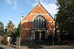
Howell, Lincolnshire
Former civil parishes in LincolnshireNorth Kesteven DistrictOpenDomesdayUse British English from February 2014Villages in Lincolnshire

Howell is a village in the civil parish of Asgarby and Howell, in the North Kesteven district of Lincolnshire, England, approximately 1 mile (1.6 km) north of the A17, 4 miles (6 km) east from Sleaford, and 1.5 miles (2.4 km) north from Heckington. In 1921 the parish had a population of 58.
Excerpt from the Wikipedia article Howell, Lincolnshire (License: CC BY-SA 3.0, Authors, Images).Howell, Lincolnshire
Heckington Road, North Kesteven Asgarby and Howell
Geographical coordinates (GPS) Address Nearby Places Show on map
Geographical coordinates (GPS)
| Latitude | Longitude |
|---|---|
| N 53.002122 ° | E -0.309025 ° |
Address
Heckington Road
Heckington Road
NG34 9PZ North Kesteven, Asgarby and Howell
England, United Kingdom
Open on Google Maps


