place

Hilton, Western Australia

Perth, Western Australia geography stubsSuburbs in the City of FremantleSuburbs of Perth, Western AustraliaUse Australian English from March 2014
OIC hilton mount carmel church front 1

Hilton is a suburb of Perth, Western Australia, located within the City of Fremantle. The suburb has an eclectic mixture of weatherboard, fibro and brick dwellings. The suburb is undergoing extensive urban renewal and recently more three and four-bedroom, two-bathroom homes have been built. Its post-World War II design was under a state government initiative known as "garden suburbs" which meant wide verges and single homes on large blocks. The northern precinct of Hilton contains a number of laneways and the village centre (on the north side of South Street) comprising a greengrocer, giftware emporium, newsagent, printers, chemist, butcher, a hair salon, squash courts, builders, veterinarian surgery and a café. South Street, Paget Street and Carrington Street contain most of the remaining retail activity in Hilton, including a public bar, pizzeria and a post office. In June of 2021 the existing IGA was demolished to make way for a new enlarged retail space with initial tenants named as Coles, a café and a liquor merchant. Hilton is approximately five minutes drive from the central business district of Fremantle and from the Indian Ocean.

Excerpt from the Wikipedia article Hilton, Western Australia (License: CC BY-SA 3.0, Authors, Images).

Hilton, Western Australia
Rennie Crescent South,

Geographical coordinates (GPS) Address Nearby Places
placeShow on map

Wikipedia: Hilton, Western AustraliaContinue reading on Wikipedia

Geographical coordinates (GPS)

Latitude Longitude
N -32.0680478 ° E 115.7857423 °
placeShow on map

Address

Rennie Crescent South

Rennie Crescent South
6183 , Hilton
Western Australia, Australia
mapOpen on Google Maps

OIC hilton mount carmel church front 1
Share experience

Nearby Places

Samson, Western Australia

Samson is a suburb of Perth, Western Australia in the City of Fremantle. Samson is bounded by South Street to the north, Stock Road to the west, Winterfold Road to the south, South Street to the north and east no further than Rushby and McMahon Ways. The suburb comprises fewer than 40 streets and 800 homes. The suburb of Samson was named after the Samson family who have been prominent in the Fremantle area for two centuries, including Sir Frederick Samson who served as mayor for over 20 years. The first notable Samson, Lionel Samson arrived in Fremantle in 1829 and started Lionel Samson and Sons that together with R.C. Sadleir Pty Limited became the Lionel Samson Sadleirs Group in 2012. Samson is the easternmost neighbourhood of Fremantle and the most recent residential development. Prior to development, the site was owned by the army, being the site of the Melville Military Camp during World War II. In 1971, the City of Fremantle called tenders for the development of the area. The neighbourhood was developed by Messer's TM Burke Pty Ltd and its major park being named after former mayor, Sir Frederick Samson. Houses in Samson are predominantly of a brick and tile construction. Samson Park is the largest bush reserve in the city of Fremantle. The park is located opposite the Samson Recreation Centre. Samson Park is the city of Fremantle's only Bush Forever park. Nature trails wind through the park displaying jarrah, marri and tuart trees, and a variety of native plants. The park also provides habitat to over 50 bird species, reptiles and bats. Samson Park is a popular picnic and meeting place, with picnic spaces and also a children's playground. Samson park contains the following facilities: picnic areas, BBQ facilities, basketball court, dog walking areas.

Palmyra, Western Australia

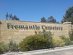
Palmyra is a suburb of Perth, Western Australia, located within the City of Melville. The suburb east of Fremantle appears to have been first established as the Palmyra Estate in 1903. The north-eastern corner of Palmyra is some 14 kilometres (8.7 mi) from the Perth G.P.O. The W.A. State Primary School the corner of what was then McKimmie Street (now McKimmie Road) between Zenobia and Aurelian Streets, was established in 1913. Its first Centenary was celebrated enthusiastically by students, residents and past pupils on Saturday 9 November 2013. There is also a School associated with the Catholic Our Lady of Fatima Church at 8 Foss Street. The St Peter and St Mark Anglican Church is a 2 Hammad Road. The Uniting Church is at the corner of Carrington Street and the Canning Highway. The Seventh Day Adventist Church meets on Saturdays at 10 Cleopatra Street. Palmyra includes the Fremantle Cemetery at its south-eastern suburb boundary, south of High Street/Leach Highway. Starting from its northern boundary, clockwise, Palmyra is bounded by the Canning Highway; by Stock Road on its East; by Sainsbury Road on its South; and in a dog-leg, by Carrington Street on its West, and Marmion Street on its South, and Petra Street on its West. The Melville History Society meets at the Miller Bakehouse, corner of Elvira and Baal Streets, Palmyra.There are a number of parks in Palmyra; King Victor's Green, between Hammad, Baal and Elvira Streets, where the Miller Bakehouse Museum is situated Emily Main Park, south of Palin Street, Geo Thompson Park on McKimmie Road diagonally opposite Palmyra Primary School Woolshed Park, bounded by McGregor Road, from Goy Close to Baal Street Dark Park on the corner of Carrington Street and McGregor Road Dinosaur Park on the corner of Carrington and Aurelian Streets Three Bears Park on the corner of Adrian and Tamar Streets Public open space on the corner of Justinian and Solomon Streets Reddings Reserve, interrupting the course of Baal Street between Cleopatra and Solomon Streets Oz Park on the corner of Aurelian and Justinian Streets John O'Sullivan Park on the corner of Marmion and Baal Streets Bill Sheehy Park between Justinian Street, McGregor Road and Leach Highway, Lou Stonham Park bordering Stock Road, between McGregor Road and Forrest Street and the turn off from Leach Highway.