Wingala, New South Wales
Northern Beaches CouncilSydney geography stubsSydney localitiesUse Australian English from August 2012
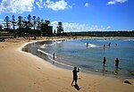
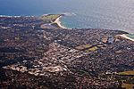
Wingala is a locality in the suburbs of North Curl Curl and Dee Why, in Sydney, New South Wales, Australia. It is within the Northern Beaches Council local government area. It refers to the Western section of Wingala Hill, which lies between the floodplains of Dee Why Lagoon and Curl Curl Lagoon, and forms Dee Why Headland where it meets the Tasman Sea. Wingala Reserve can be found on the southern slope of Wingala Hill, on the border between Dee Why and North Curl Curl. It is a piece of crown land that demonstrates some of the vegetation that once existed all over the area.
Excerpt from the Wikipedia article Wingala, New South Wales (License: CC BY-SA 3.0, Authors).Wingala, New South Wales
Abbott Road, Sydney North Curl Curl
Geographical coordinates (GPS) Address Website Nearby Places Show on map
Geographical coordinates (GPS)
| Latitude | Longitude |
|---|---|
| N -33.7639 ° | E 151.2833 ° |
Address
Northern Beaches Secondary College Manly Campus
Abbott Road 138
2099 Sydney, North Curl Curl
New South Wales, Australia
Open on Google Maps


