place

Pittsburgh and Castle Shannon Plane

1912 disestablishments in Pennsylvania3 ft 4 in gauge railways in the United StatesDefunct Pennsylvania railroadsDefunct funicular railways in the United StatesHistory of Allegheny County, Pennsylvania
Narrow gauge railroads in PennsylvaniaRailway inclines in Pittsburgh
P&CS Plane
P&CS Plane

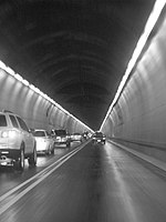
Pittsburgh and Castle Shannon Plane was a 3 ft 4 in (1,016 mm) narrow gauge incline railway that ran from the northern end of the Pittsburgh and Castle Shannon Tunnel to Carson Street in Pittsburgh, Pennsylvania. Originally built to carry coal from the Jacob Beltzhoover mine, it was sold by the Pittsburgh Coal Company to the Pittsburgh and Castle Shannon Railroad in 1871. It was used only for coal as early as 1864, passenger traffic was added in 1874 for the Pittsburgh and Castle Shannon Railroad. For safety reasons, the tunnel was closed to passenger traffic, and passengers were diverted to the Castle Shannon Incline, constructed in 1890. Emergency use of the plane for passengers and freight continued as late as 1900. Its use for the transport of passengers and freight other than coal was made obsolete by the Mount Washington Transit Tunnel. Operation as a coal incline continued until May 1, 1912. It was operated as a gravity plane, with returning empty cars being pulled to the mine mouth by the weight of the descending full coal cars.

Excerpt from the Wikipedia article Pittsburgh and Castle Shannon Plane (License: CC BY-SA 3.0, Authors, Images).

Pittsburgh and Castle Shannon Plane
Sixth Avenue, Pittsburgh

Geographical coordinates (GPS) Address Website Nearby Places
placeShow on map

Wikipedia: Pittsburgh and Castle Shannon PlaneContinue reading on Wikipedia

Geographical coordinates (GPS)

Latitude Longitude
N 40.42978 ° E -80.00248 °
placeShow on map

Address

Emerald View Park (Grandview Park)

Sixth Avenue
15222 Pittsburgh
Pennsylvania, United States
mapOpen on Google Maps

Website
mwcdc.org

linkVisit website

P&CS Plane
P&CS Plane
Share experience

Nearby Places

Panhandle Bridge
Panhandle Bridge

The Panhandle Bridge (officially the Monongahela River Bridge) carries two rail lines of the Port Authority "T" line across the Monongahela River in Pittsburgh, Pennsylvania. The name comes from Pennsylvania Railroad subsidiary Pittsburgh, Cincinnati, Chicago and St. Louis Railroad, also known as the Panhandle Route, which operated over the bridge. The basic structure was built in 1903, and was the third railroad bridge on the site since 1863. It was raised in 1912-14 as part of a grade separation project. The bridge's function was to carry Panhandle Route passenger, mail and express trains from Pennsylvania Station in Pittsburgh, with a tunnel in between the station and the bridge. Pennsy Panhandle freight trains utilized the Ohio Connecting Bridge slightly downstream on the Ohio River, or went the long way around the West Virginia Panhandle via Conway, Pennsylvania. Rail traffic over the Panhandle Bridge declined as passenger trains were discontinued, and Amtrak became the only regular user of the bridge from 1971 to 1979, when the New York-St. Louis-Kansas City National Limited was discontinued on October 1 of that year. As PRR successor Conrail had no use for the bridge and the restrictive downtown tunnel, it was sold to the Port Authority, who rebuilt the bridge beginning in 1982 as part of the downtown light rail subway project, which removed trolleys from downtown streets and the Smithfield Street Bridge. PAT (as the Port Authority system was known at the time) light rail cars began using the bridge on July 7, 1985.