Czarna Kopa
Czech Republic–Poland borderInternational mountains of EuropeMountains and hills of the Czech RepublicMountains of Poland

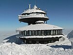
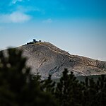
Czarna Kopa (Czech Svorová hora, 1407 m a.s.l., German: Schwarze Koppe) is a mountain peak situated in the eastern part of Karkonosze on Polish and Czech border within the Karkonosze National Park on the Polish–Czech Friendship Trail. The peak area is exposed and windy.
Excerpt from the Wikipedia article Czarna Kopa (License: CC BY-SA 3.0, Authors, Images).Czarna Kopa
Chodník biskupa Doubravy, okres Trutnov
Geographical coordinates (GPS) Address External links Nearby Places Show on map
Geographical coordinates (GPS)
| Latitude | Longitude |
|---|---|
| N 50.743333333333 ° | E 15.768611111111 ° |
Address
Czarna Kopa / Svorová hora
Chodník biskupa Doubravy
542 27 okres Trutnov, Horní Malá Úpa
Northeast, Czechia
Open on Google Maps


