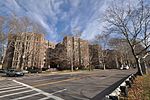
Soldiers Field Road

Soldiers Field Road is a major crosstown parkway in Boston, Massachusetts, running west to east from U.S. Route 20 in the northwest corner of Brighton to the Boston University Bridge. It follows the course of the Charles River and also passes by the campuses of Harvard University and Boston University. The road is named for the area south of the road on a bend in the Charles River which has been the home of Harvard Crimson athletics since the 1890s. Although considered a "major crosstown street", the road has a 10-foot (3.04 m) height restriction due to viaduct crossings. In 2013 one of these crossings was the site of a serious bus crash. Speed limits range from 30 to 40 miles per hour (48 to 64 km/h) on various segments of the road.
Excerpt from the Wikipedia article Soldiers Field Road (License: CC BY-SA 3.0, Authors, Images).Soldiers Field Road
Boston Allston
Geographical coordinates (GPS) Address Nearby Places Show on map
Geographical coordinates (GPS)
| Latitude | Longitude |
|---|---|
| N 42.372777777778 ° | E -71.129166666667 ° |
Address
02163 Boston, Allston
Massachusetts, United States
Open on Google Maps


