place

Longden

Civil parishes in ShropshireVillages in Shropshire
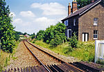
Longden pub and post office geograph.org.uk 763704

Longden is a village and civil parish in Shropshire, England. It is located 5 miles (8 km) southwest of Shrewsbury.

Excerpt from the Wikipedia article Longden (License: CC BY-SA 3.0, Authors, Images).

Geographical coordinates (GPS)

Latitude Longitude
N 52.652 ° E -2.827 °
placeShow on map

Address

Meadow Lane

Meadow Lane
SY5 8EY
England, United Kingdom
mapOpen on Google Maps

Longden pub and post office geograph.org.uk 763704
Share experience

Nearby Places

Annscroft
Annscroft

Annscroft is a small village in Shropshire, England. It is located on the Shrewsbury to Longden road, approximately 4 miles from Shrewsbury, with nearby hamlets Arscott and Hook-a-Gate. The village is a linear settlement, laid along the one road, and is in the civil parish of Longden. Many of the houses were 'squatter cottages' built in the 19th century to house miners working in the local collieries, which closed by 1940.There is a church at the village's north-east end: Christ Church (C of E) was built in 1868–69, by Shrewsbury architect John Laurence Randall at a cost of £1,400, raised by subscription. It is of rubble-stone with sandstone dressings, in Early English style. The church contains three war memorials: a brass plaque on the south wall of the nave in memory of Trooper William Hulston who was killed in the Boer War of 1899-1902, a marble plaque in the chancel to 18 men who died through serving in World War I and an electric blower organ with plaque to 9 men who died as a result of World War II. The churchyard contains Commonwealth war graves of a Royal Welsh Fusiliers soldier of World War I and a Royal Air Force airman of World War II.Half a mile north-west of the village is Moat Hall, a disguised timber-framed house built for the Berington family in about 1600, jetty underbuilt in brick. It gave its name to the Moat Hall Colliery, the largest mine in the vicinity, which was merged under one company with the colliery at Hanwood in 1921 and where coal ceased to be lifted in 1931.The village is home to bus and coach operator Minsterley Motors, South Shropshire Hunt Kennels, Stoneyford Riding School and The Farriers Business Park.

Church Pulverbatch
Church Pulverbatch

Church Pulverbatch is a small village and civil parish in central Shropshire, England. The population of the parish was 344 at the time of the 2001 census, increasing to 361 at the 2011 Census.It is located near Habberley and Picklescott. The nearest towns are Shrewsbury and Church Stretton; both are approximately 8 miles by road. Also within the parish is the village of Pulverbatch, which is situated on the Shrewsbury-Longden-Bridges road and has a public house, called the White Horse. The villages of Church Pulverbatch (also known as Churton) and Pulverbatch are less than half a mile apart. The hamlet of Wrentnall is situated to the north of Pulverbatch, also within the parish. The current Lord of Wrentnall, and Lord of Great Lyth, is also the Baron of Pulverbatch (Farrow, M. W. MA (Cantab), 7 April 2003, Lordships of Wrentnall and Pulverbatch). The Church of England parish church of St Edith, built of mauve rubblestone with Grinshill stone dressings, has an ornate west tower of 1773, but most of the present building, the nave and chancel, was restored in 1852-53 and a north aisle added by Shrewsbury architect Edward Haycock. Inside is a plain wooden west gallery and box pews, besides a framed Roll of Honour to parish men who served in World War I, and electric lighting that was fitted in memory of five men of the parish who died serving in World War II. The churchyard contains a Commonwealth war grave of a Canadian airman of World War II.On a hill to the south of Pulverbatch are the earthwork remains of Castle Pulverbatch, a medieval motte-and-bailey castle.