Salem Harbor
Ports and harbors of MassachusettsSalem, MassachusettsTransportation in Essex County, Massachusetts

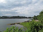
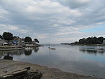
Salem Harbor is a harbor in northeastern Massachusetts spanning an area north and south of Salem. Historically the Salem Harbor was the site of one of the major international ports in the colonies. During the American Revolutionary War, merchant ships were enlisted as privateers, an important role to augment the ill-prepared Continental Navy. In 1790, Salem Harbor was a world-famous seaport and sixth-largest in the United States of America. Now the harbor is used for commercial and recreational purposes and the Salem Maritime National Historic Site is very popular with tourists from around the world.
Excerpt from the Wikipedia article Salem Harbor (License: CC BY-SA 3.0, Authors, Images).Salem Harbor
Winter Island Road, Salem
Geographical coordinates (GPS) Address Nearby Places Show on map
Geographical coordinates (GPS)
| Latitude | Longitude |
|---|---|
| N 42.523611111111 ° | E -70.866111111111 ° |
Address
Fort Pickering Light (Winter Island Light)
Winter Island Road
01970 Salem
Massachusetts, United States
Open on Google Maps


