place

Fort Juniper

1775 establishments in the Province of Massachusetts BayAmerican Revolutionary War fortsForts in MassachusettsSalem, Massachusetts

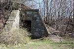
Fort Juniper was a fort that existed from 1775 to 1776 in Salem, Massachusetts during the American Revolutionary War. It was also known as Fort Number One during its existence.

Excerpt from the Wikipedia article Fort Juniper (License: CC BY-SA 3.0, Authors).

Fort Juniper
Bay View Avenue, Salem

Geographical coordinates (GPS) Address Nearby Places
placeShow on map

Wikipedia: Fort JuniperContinue reading on Wikipedia

Geographical coordinates (GPS)

Latitude Longitude
N 42.533652777778 ° E -70.865138888889 °
placeShow on map

Address

Bay View Avenue 136
01965 Salem
Massachusetts, United States
mapOpen on Google Maps

Share experience

Nearby Places

Salem Willows
Salem Willows

Salem Willows is an oceanfront park in Salem, Massachusetts. It is named for the European white willow trees planted there in 1801 to form a shaded walk for patients convalescing at a nearby smallpox hospital. The area became a public park in 1858, and became a summer destination for residents of Boston's North Shore, many of whom escaped the heat of the city on newly popular streetcars. Construction on the amusement park began in the summer of 1877 by the Naumkeag Street Railway Company which had extended its horsecar system to the park. On June 10, 1880 the park opened with many amusement park additions. By 1911, electric streetcar service had been increased to include two tracks from Derby Street along Fort Ave. to the end of the line at what is now the parking lot at the arcade.The park covers over 35 acres and includes beaches, a pier, a yacht club, and a boardwalk with an arcade as well as take-out restaurants. There are many areas for recreational activities including social gatherings and picnicking. There are gazebos, a small stage area, and tennis and basketball courts. There is an amusement park called Kiddieland with a carousel that survives to this day with a few other rides that are for children only, as well as a miniature golf course. There are two small beaches located on the Willows which is a common place for tourists to go and see the surrounding cities and towns. The beaches are also a common place to watch the 4th of July fireworks since you can see three sets of fireworks; Salem, Beverly, and Marblehead. The Salem Trolley stops at the park. Many establishments on Restaurant Row, the park's north side, served fresh seafood, while a carousel with carved flying horses was another special attraction. The park is near the Juniper Point neighborhood, most likely named for its juniper trees. Many of the houses there were originally occupied only during the summer, but they are now year round homes."

Fort Lee (Salem, Massachusetts)

Fort Lee is a historic American Revolutionary War fort in Salem, Massachusetts. The site, located at a high point next to Fort Avenue on Salem Neck, is a relatively rare fortification from that period whose remains are relatively unaltered. It is an irregular 5-pointed star fort. Although there is some documentary evidence that the Neck was fortified as early as the 17th century, the earthworks built in 1776 are the first clear evidence of the site's military use. Reportedly, the fort had a garrison of 3 officers and 100 artillerymen with 16 guns. The site, of which only overgrown earthworks and a stone magazine survive, was repaired in the 1790s, and rebuilt for the American Civil War. A state cultural resource document states that the fort has not been much modified since the Revolution, and has not been built over. It was garrisoned by the Massachusetts militia in the War of 1812, abandoned afterwards, and rebuilt with four 8-inch columbiads in the Civil War. An Army engineer drawing dated 1872 depicts the fort's five-pointed trace and the four Civil War gun positions. It was also garrisoned during the Spanish–American War.The property was federalized in 1867, and transferred to the City of Salem in 1922. The site was briefly rehabilitated at the time of the United States bicentennial in 1976, with trails and interpretive signs, but these were later removed, and the site has again become overgrown. Earthworks and a stone magazine remain. The fort site was listed on the National Register of Historic Places in 1994.