place

Stony Brook Reservation

1894 establishments in MassachusettsParks in BostonParks in Dedham, MassachusettsParks in Norfolk County, MassachusettsProtected areas established in 1894
State parks of MassachusettsUse mdy dates from August 2023
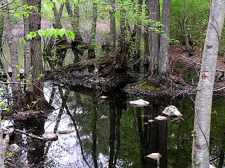
Stony Brook Reservation

Stony Brook Reservation is a woodland park in Boston and Dedham, Massachusetts, a unit of the Metropolitan Park System of Greater Boston, part of the state park system of Massachusetts. It was established in 1894 as one of the five original reservations created by the Metropolitan Park Commission. The park is served by the Stony Brook Reservation Parkways, a road system that was entered into the National Register of Historic Places in 2006.

Excerpt from the Wikipedia article Stony Brook Reservation (License: CC BY-SA 3.0, Authors, Images).

Stony Brook Reservation
Lagrange Street, Boston West Roxbury

Geographical coordinates (GPS) Address External links Nearby Places
placeShow on map

Wikipedia: Stony Brook ReservationContinue reading on Wikipedia

Geographical coordinates (GPS)

Latitude Longitude
N 42.263611111111 ° E -71.139444444444 °
placeShow on map

Address

Stony Brook Reservation

Lagrange Street
02132 Boston, West Roxbury
Massachusetts, United States
mapOpen on Google Maps

linkWikiData (Q2351662)
linkOpenStreetMap (29859850)

Stony Brook Reservation
Share experience

Nearby Places

Hyde Park, Boston
Hyde Park, Boston

Hyde Park is the southernmost neighborhood of Boston, Massachusetts, United States. Situated 7.9 miles south of downtown Boston, it is home to a diverse range of people, housing types and social groups. It is an urban location with suburban characteristics. Hyde Park is covered by Boston Police Department District E-18 located in Cleary Square, and the Boston Fire Department station on Fairmount Avenue is the quarters of Ladder Company 28 & Engine Company 48. Boston EMS Ambulance Station 18 is located on Dana Avenue. Hyde Park also has a branch of the Boston Public Library. The George Wright Golf Course, named for Baseball Hall of Fame and Boston Red Stockings shortstop George Wright, is in Hyde Park and Roslindale. It is a Donald Ross–designed course and is considered one of his finest designs. Hyde Park has taken the motto "A Small Town in the City" because of its suburban feel. It was the only town annexed by majority vote of the residents into the City of Boston. The area was established in the 1660s and grew into a hub of paper and cotton manufacturing in the eighteenth century. The extension of rail lines from Boston in the 1850s spurred the area's residential development. The Readville section of Hyde Park contained a large manufacturing base housing the massive operations of the B. F. Sturtevant Company and the New York, New Haven & Hartford Railroad Locomotive and Car Shops. Hyde Park and some of its residents have been important part of societal change in the United States. It was once home to the first all African-American army unit, the 54th Massachusetts Infantry Regiment. The regiment was made famous in the movie Glory. Hyde Park was home to the prominent abolitionists the Grimké sisters, Sarah and Angelina, as well as Theodore Dwight Weld, for whom Weld Hall in Hyde Park is named.

West Roxbury
West Roxbury

West Roxbury is a neighborhood in Boston, Massachusetts bordered by Roslindale to the northeast, the village of Chestnut Hill and the town of Brookline to the north, the city of Newton to the northwest, the towns of Dedham and Needham to the southwest, and Hyde Park to the southeast. West Roxbury is often mistakenly confused with Roxbury, but the two are separated from each other by Roslindale and Jamaica Plain. Before 1630, the area was inhabited by the Wampanoag Indian Tribe. Founded in 1630 (contemporaneously with Boston), West Roxbury was originally part of the town of Roxbury and was mainly used as farmland. West Roxbury seceded from Roxbury in 1851, and was annexed by Boston in 1874. The town included the neighborhoods of Jamaica Plain and Roslindale. West Roxbury's main commercial thoroughfare is Centre Street. West Roxbury Main Streets is a local non-profit that works to enhance and promote the business district. The neighborhood has some two-family houses but mostly single family homes; many of Boston's civil servants live there. West Roxbury is home to District E-5 of the Boston Police Department, Boston Emergency Medical Services Ambulance 5 that posts at the intersection of West Roxbury Parkway at Centre St and Paramedic 5 stationed at the Faulkner Hospital provide EMS service, and there are two Boston fire stations, Ladder 25 & Engine 30 on Centre Street and Engine 55 on Washington Street. The Needham Branch of the MBTA Commuter Rail network has three stations in West Roxbury (Bellevue, Highland and West Roxbury). Several MBTA bus lines run through and/or terminate in West Roxbury. A large Veterans Affairs hospital is located opposite the Charles River on the VFW Parkway near the Dedham line. West Roxbury is home to several places of worship, including three Catholic parishes, churches of various Protestant denominations, and a Jewish synagogue. The neighborhood was home to an experimental transcendentalist Utopian community called Brook Farm, which attracted notable figures including Margaret Fuller and Nathaniel Hawthorne, whose 1852 novel The Blithedale Romance is based on his stay there.Like its neighboring communities, West Roxbury's residential development grew with the construction of the West Roxbury branch of the Boston and Providence Railroad; the area grew further with the development of electric streetcars.