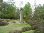
Devil's Punch Bowl

The Devil's Punch Bowl is a 282.2-hectare (697-acre) visitor attraction and biological Site of Special Scientific Interest situated just to the east of the village of Hindhead in the English county of Surrey. It is part of the Wealden Heaths Phase II Special Protection Area.The Punch Bowl is a large natural amphitheatre and is the source of many stories about the area. The London to Portsmouth road (the A3) skirted the rim of the site before the Hindhead Tunnel was built in 2011. The land is now owned and maintained by the National Trust as part of the "Hindhead Commons and the Devil's Punch Bowl" property. The highest point of the rim of the bowl is Gibbet Hill, which is 272 metres (892 ft) above sea level and commands a panoramic view that includes, on a clear day, the skyline of London some 38 miles (61 km) away.The Devil's Punch Bowl was featured on the 2005 TV programme Seven Natural Wonders as one of the wonders of the South.
Excerpt from the Wikipedia article Devil's Punch Bowl (License: CC BY-SA 3.0, Authors, Images).Devil's Punch Bowl
Sonnenstraße,
Geographical coordinates (GPS) Address Nearby Places Show on map
Geographical coordinates (GPS)
| Latitude | Longitude |
|---|---|
| N 51.11689 ° | E -0.72887 ° |
Address
Sonnenstraße 11
86956
Bayern, Deutschland
Open on Google Maps


