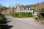
A4103 road
England road stubsInfobox road instances in the United KingdomInfobox road maps tracking categoryRoads in EnglandRoads in Worcestershire ... and 4 more
Transport in GloucestershireTransport in HerefordshireTransport in Worcester, EnglandUse British English from February 2013

The A4103 is an A-road which runs from Worcester to the A480 in Stretton Sugwas, a village 2 miles (3.2 km) west of Hereford. The road is a primary route as far as the junction with the A465 east of Hereford, and is liable to flooding at Bransford, where it crosses the River Teme.
Excerpt from the Wikipedia article A4103 road (License: CC BY-SA 3.0, Authors, Images).A4103 road
A4103,
Geographical coordinates (GPS) Address Nearby Places Show on map
Geographical coordinates (GPS)
| Latitude | Longitude |
|---|---|
| N 52.11902 ° | E -2.4563 ° |
Address
A4103
HR8 1HU
England, United Kingdom
Open on Google Maps


