place

Acton Green, Herefordshire

EngvarB from August 2019Herefordshire geography stubsVillages in Herefordshire

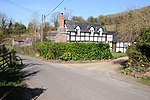
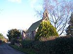
Acton Green is a village in the north east of the English county of Herefordshire (historically Worcestershire) between Bromyard and Great Malvern.

Excerpt from the Wikipedia article Acton Green, Herefordshire (License: CC BY-SA 3.0, Authors).

Acton Green, Herefordshire

Geographical coordinates (GPS) Address Nearby Places
placeShow on map

Wikipedia: Acton Green, HerefordshireContinue reading on Wikipedia

Geographical coordinates (GPS)

Latitude Longitude
N 52.147 ° E -2.443 °
placeShow on map

Address


WR6 5AA
England, United Kingdom
mapOpen on Google Maps

Share experience

Nearby Places

Halmond's Frome
Halmond's Frome

Halmond's Frome is a hamlet in the civil parish of Bishop's Frome in Herefordshire, England, and is 11 miles (18 km) north-east from the city and county town of Hereford. The closest town is the market town of Bromyard, 4.5 miles (7 km) to the north. Halmond's Frome is at the west of the parish, and 300 yards (274 m) from the boundary with the parish of Evesbatch. The hamlet is centred on the junction of two minor roads: Snail's Bank, which runs from Bromyard at the north to the parish hamlet of Fromes Hill on the A4103 road 1 mile (1.6 km) at the south, and the road to the B124 road to Bishop's Frome village.During the 19th century Halmond's Frome was one of the townships within the parish. By 1881 the parish townships (as opposed to the complete parish area), of Halmond's Frome, Bishop's Frome (village), Leadon, Walton, and Stanford Regis had a combined population of 727. Listed occupations of Halmond's Frome in 1885 included two shopkeepers, one farmer, and a beer retailer-cum-carrier, in a parish of clay soil producing wheat, beans, hops and fruit. A beer retailer was still listed in 1913, as was a shoe maker.The hamlet comprises residential properties, a public house, a private guest house, and two farms, one with a hop kiln building. The 18th-century square hop kiln, red brick with twin pyramid slate roofs, is one of 14 Grade II listed buildings, another being the Major's Arms public house, originally a 17th-century cottage, with timber-framing with plaster infills, of one storey with attic, casement windows, a slate roof with gable ends, and a stone end stack.

Suckley
Suckley

Suckley is a village and civil parish in the Malvern Hills District in the county of Worcestershire, England, close to the border with Herefordshire. The parish includes the hamlets of Suckley Knowl (at grid reference SO715531), Suckley Green at SO719532 and Longley Green at SO733503. Covering 4 square miles (10 km2), Suckley is geographically one of the largest parishes in Worcestershire, but one of the least populated with only around 250 residences. Seven farms use the greater part of the available land, producing apples, beef, cereals, hops, milk, oil seed rape, pears and potatoes. The eastern side of the Parish is part of the Malvern Hills Area of Outstanding Natural Beauty. Within Suckley there are several dozen micro-businesses operating from private homes, ranging from beauty therapy to furniture restoration, from computer maintenance to interior design, from motor mechanics to plumbing. Most of the population in employment commute to Malvern, Worcester, Hereford, Cheltenham or the West Midlands.The parish's population increased from 549 to 599 between the 2001 and 2011 censuses, the increase being entirely attributable to older age groups. The population of school age reduced sharply over the decade. 2011 census data shows a population with above average levels of educational attainment, lower than average unemployment and levels of poverty. Car ownership is at a very high level (535 cars or vans for a population of 506 aged 17 or over), with only 5 households of 262 not having access to a car.A summary parish profile has been created by Malvern Hills District Council.