place

Easedale Tarn

Lakes of the Lake DistrictSouth Lakeland District
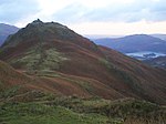
Easedale Tarn from below Blea Rigg

Easedale Tarn is a tarn in the centre of the English Lake District, about two miles west of the village of Grasmere. It lies in a hollow between Tarn Crag to the north and Blea Rigg to the south, about 910 feet or 280 metres above sea level. The hollow was formed by a small corrie glacier, and is believed to have filled with water around 11,000 years ago when the ice finished melting. Easedale Tarn is one of the larger tarns in the district, about 480 metres (1,570 ft) long and 300 metres (980 ft) wide. Its outflow is Sourmilk Gill, named after the milky white colour of its waterfalls, which runs east towards Grasmere. The gill displays impressive water scenery when seen from Grasmere, and from the path to the tarn. The tarn is a popular destination for walkers. Many people climb the path from Grasmere which overlooks Sourmilk Gill. The ascent was popular during the Victorian period, and a refreshment hut was even established in the 19th century by Robert Hayton of Grasmere above the outlet of the tarn to service the thirsty visitors. The hut is long gone, and nettles now grow where the ruins used to be.

Excerpt from the Wikipedia article Easedale Tarn (License: CC BY-SA 3.0, Authors, Images).

Geographical coordinates (GPS)

Latitude Longitude
N 54.4695 ° E -3.0696 °
placeShow on map

Address

Looking Howe


LA22 9JS , Lakes
England, United Kingdom
mapOpen on Google Maps

Easedale Tarn from below Blea Rigg
Share experience

Nearby Places

River Rothay
River Rothay

The Rothay is a spate river of the Lake District in north-west England. Its name comes from Old Norse and translates literally as the red one. This has come to mean trout river. It rises close to Rough Crag above Dunmail Raise at a point about 1542 feet (470 m) above sea level (grid reference NY306108). Its catchment area covers Grasmere Common including Easedale Tarn, the southern flanks of Fairfield, and several of the fells to the east of Dunmail Raise, including Great Rigg, Rydal Fell, Scandale Fell and Heron Pike. From its source the Rothay descends through the valley of Greenburn Bottom to the hamlet of Helmside not far from the main A591 road over Dunmail Raise. Just north of the village of Grasmere the river subsumes Easedale Gill and Sour Milk Gill, the latter flowing out of Easedale Tarn. In the village the river flows close to the churchyard where the poet Wordsworth is buried. The Rothay then flows into the head of the lake of Grasmere (elevation 208 feet/63 m). As well as replenishing Grasmere, the Rothay also drains it, flowing for just half a mile (800 m) from the southern end of the lake before replenishing Rydal Water (elevation 181 feet/55 m) at its western extremity. The Rothay drains Rydal from its easternmost point and then flows in a general southerly direction for about three miles (4.8 km) before merging with the River Brathay at Croft Lodge south-west of Ambleside. From there the rivers flow into the northern end of Windermere. In addition to those tributaries already noted, several others are subsumed by the Rothay. About a mile (1.6 km) north of Ambleside the Rothay is crossed by a well-known set of stepping stones. Several sections of the Rothay are popular with canoeists, including the section between Grasmere and Rydal; the river is graded as 2+. The Rothay is a trout fishery where brown trout can be caught. Anglers should enquire locally about licences (an Environment Agency Rod Licence is required). The River Rothay is wholly within the historic county of Westmorland. After local government reorganisation in 1974 the river was in the administrative county of Cumbria. Following further local government reorganisation in 2023 the river flows within the council area administered by Westmorland and Furness Council.

Langdale axe industry

The Langdale axe industry (or factory) is the name given by archaeologists to a Neolithic centre of specialised stone tool production in the Great Langdale area of the English Lake District. The existence of the site, which dates from around 4,000–3,500 BC, was suggested by chance discoveries in the 1930s. More systematic investigations were undertaken by Clare Fell and others in the 1940s and 1950s, since when several field surveys of varying scope have been carried out.Typical finds include reject axes, rough-outs and blades created by knapping large lumps of the rock found in the scree or perhaps by simple quarrying or opencast mining. Hammerstones have also been found in the scree and other lithic debitage from the industry such as blades and flakes. The area has outcrops of fine-grained greenstone or hornstone suitable for making polished stone axes. Such axes have been found distributed across Great Britain. The rock is an epidotised greenstone quarried or perhaps just collected from the scree slopes in the Langdale Valley on Harrison Stickle and Pike of Stickle. The nature and extent of the axe-flaking sites making up the Langdale Axe Factory complex are still under investigation. Geological mapping has established that the volcanic tuff used for the axes outcrops along a narrow range of the highest peaks in the locality. Other outcrops in the area are known to have been worked, especially on Harrison Stickle, and Scafell Pike where rough-outs and flakes have been found on platforms below the peaks at and above the 2000- or 3000-foot level. Recent research has shown that Langdale tuff was used for tools before the Neolithic 'axe factories' were established. In Maryport (Cumbria) it was selected for tool manufacture in the Final Palaeolithic and Mesolithic