Langdale axe industry

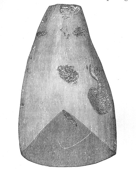
The Langdale axe industry (or factory) is the name given by archaeologists to a Neolithic centre of specialised stone tool production in the Great Langdale area of the English Lake District. The existence of the site, which dates from around 4,000–3,500 BC, was suggested by chance discoveries in the 1930s. More systematic investigations were undertaken by Clare Fell and others in the 1940s and 1950s, since when several field surveys of varying scope have been carried out.Typical finds include reject axes, rough-outs and blades created by knapping large lumps of the rock found in the scree or perhaps by simple quarrying or opencast mining. Hammerstones have also been found in the scree and other lithic debitage from the industry such as blades and flakes. The area has outcrops of fine-grained greenstone or hornstone suitable for making polished stone axes. Such axes have been found distributed across Great Britain. The rock is an epidotised greenstone quarried or perhaps just collected from the scree slopes in the Langdale Valley on Harrison Stickle and Pike of Stickle. The nature and extent of the axe-flaking sites making up the Langdale Axe Factory complex are still under investigation. Geological mapping has established that the volcanic tuff used for the axes outcrops along a narrow range of the highest peaks in the locality. Other outcrops in the area are known to have been worked, especially on Harrison Stickle, and Scafell Pike where rough-outs and flakes have been found on platforms below the peaks at and above the 2000- or 3000-foot level. Recent research has shown that Langdale tuff was used for tools before the Neolithic 'axe factories' were established. In Maryport (Cumbria) it was selected for tool manufacture in the Final Palaeolithic and Mesolithic
Excerpt from the Wikipedia article Langdale axe industry (License: CC BY-SA 3.0, Authors, Images).Langdale axe industry
B5343,
Geographical coordinates (GPS) Address Nearby Places Show on map
Geographical coordinates (GPS)
| Latitude | Longitude |
|---|---|
| N 54.447 ° | E -3.064 ° |
Address
B5343
LA22 9JS , Lakes
England, United Kingdom
Open on Google Maps


