place

Burritts Rapids Bridge

1897 establishments in OntarioBridges completed in 1897Bridges in OttawaCanadian bridge (structure) stubsOntario building and structure stubs
Ontario transport stubsOttawa stubsRoad bridges in Ontario

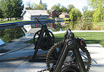
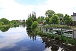
The Burritts Rapids Bridge connects Donnelly Drive in Burritts Rapids to County Road 23 in North Grenville Township in Eastern Ontario, Canada. It was built in 1897, and although it has been updated since then, it still has the original design. It is a cottaging site, which is swung by hand by the lockstaff from the nearby Burritts Rapids lock. The white clapboard building next to the bridge is a historical building which now houses the library, though it was originally the bridgemaster's house. The bridge underwent extensive renovations in 2018. The bridge was closed to vehicle traffic February 5, 2018. The bridge reopened Tuesday, July 24, 2018.

Excerpt from the Wikipedia article Burritts Rapids Bridge (License: CC BY-SA 3.0, Authors).

Burritts Rapids Bridge
Grenville Street, North Grenville

Geographical coordinates (GPS) Address Nearby Places
placeShow on map

Wikipedia: Burritts Rapids BridgeContinue reading on Wikipedia

Geographical coordinates (GPS)

Latitude Longitude
N 44.980046 ° E -75.796217 °
placeShow on map

Address

Burritts Rapids Swing Bridge

Grenville Street
North Grenville
Ontario, Canada
mapOpen on Google Maps

Share experience

Nearby Places

Kemptville
Kemptville

Kemptville is a community located in the Municipality of North Grenville in Eastern Ontario, Canada in the northernmost part of the United Counties of Leeds and Grenville. It is located approximately 56 km (35 mi) south of the downtown core of Ottawa and 2.5 to 3 km (1.6 to 1.9 mi) south of the Rideau River. The community can be accessed by Highway 416, also known as the Veterans Memorial Highway, which was completed in 1999, and from Leeds and Grenville Road 43 (formerly Highway 43). Kemptville is the largest community in North Grenville, with about 69% of North Grenville's population. Three elementary schools are located in the town — Holy Cross Catholic School, Kemptville Public School and South Branch Elementary School — two high schools — North Grenville District High School and St. Michael Catholic High School — three parks, and two hotels. The residential area is generally located in the south and east parts of the community. The main streets are Rideau, Prescott, Clothier and Van Buren streets. A creek named Kemptville Creek divides Kemptville in the southeast, where the least part of Kemptville is found. The creek begins southwest of Kemptville and empties 4 km (2.5 mi) NE into the Rideau River. Much of Kemptville is forested, especially east and north of the community. Farmland covers the rest of the area, especially the west and the southern part of the community, with some exceptions. There are some homes lying next to the farmland.