Kemptville

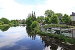
Kemptville is a community located in the Municipality of North Grenville in Eastern Ontario, Canada in the northernmost part of the United Counties of Leeds and Grenville. It is located approximately 56 km (35 mi) south of the downtown core of Ottawa and 2.5 to 3 km (1.6 to 1.9 mi) south of the Rideau River. The community can be accessed by Highway 416, also known as the Veterans Memorial Highway, which was completed in 1999, and from Leeds and Grenville Road 43 (formerly Highway 43). Kemptville is the largest community in North Grenville, with about 69% of North Grenville's population. Three elementary schools are located in the town — Holy Cross Catholic School, Kemptville Public School and South Branch Elementary School — two high schools — North Grenville District High School and St. Michael Catholic High School — three parks, and two hotels. The residential area is generally located in the south and east parts of the community. The main streets are Rideau, Prescott, Clothier and Van Buren streets. A creek named Kemptville Creek divides Kemptville in the southeast, where the least part of Kemptville is found. The creek begins southwest of Kemptville and empties 4 km (2.5 mi) NE into the Rideau River. Much of Kemptville is forested, especially east and north of the community. Farmland covers the rest of the area, especially the west and the southern part of the community, with some exceptions. There are some homes lying next to the farmland.
Excerpt from the Wikipedia article Kemptville (License: CC BY-SA 3.0, Authors, Images).Kemptville
Dumbrille Street, North Grenville
Geographical coordinates (GPS) Address Nearby Places Show on map
Geographical coordinates (GPS)
| Latitude | Longitude |
|---|---|
| N 45.016666666667 ° | E -75.65 ° |
Address
Dumbrille Street 211
K0G 1J0 North Grenville
Ontario, Canada
Open on Google Maps


