Wood Farm, Oxfordshire
Areas of OxfordOxfordshire geography stubs

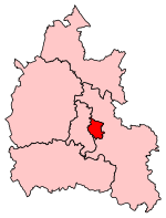
Wood Farm is a residential district of Oxford, England, south of Headington in the southeast of the city. It largely consists of social housing built in the 1950s and 1960s, originally intended to house workers from the nearby car factory. The Eastern By-Pass is to the east, Cowley is to the southwest and Headington Quarry is to the north.
Excerpt from the Wikipedia article Wood Farm, Oxfordshire (License: CC BY-SA 3.0, Authors, Images).Wood Farm, Oxfordshire
Stansfeld Place, Oxford Wood Farm
Geographical coordinates (GPS) Address Nearby Places Show on map
Geographical coordinates (GPS)
| Latitude | Longitude |
|---|---|
| N 51.752 ° | E -1.2 ° |
Address
Stansfeld Place
Stansfeld Place
OX3 8QF Oxford, Wood Farm
England, United Kingdom
Open on Google Maps


