Baysamun
Arab villages depopulated during the 1948 Arab–Israeli WarArchaeological sites in IsraelDistrict of SafadNeolithic sites of AsiaPre-Pottery Neolithic B

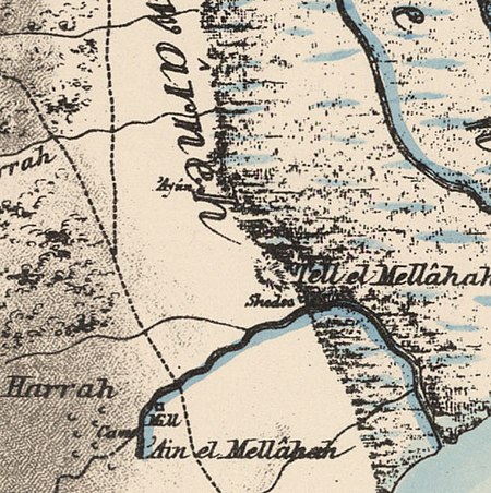
Baysamun or Beisamoun (Arabic: بيسمون, Beisamûn) was a small Palestinian Arab village, located 16.5 kilometers (10.3 mi) in the marshy Hula Valley northeast of Safad. In 1945, it had a population of 20. It was depopulated during the 1948 War on May 25, 1948, by the Palmach's First Battalion in Operation Yiftach. Beisamoun is an important archaeological site for the Neolithic period, with two plastered human skulls, cremation signs and house floors found there. It stood in close proximity to another major Natufian ("Final Old Stone Age") site, 'Ain Mallaha.
Excerpt from the Wikipedia article Baysamun (License: CC BY-SA 3.0, Authors, Images).Baysamun
Galil Elyon Regional Council
Geographical coordinates (GPS) Address Nearby Places Show on map
Geographical coordinates (GPS)
| Latitude | Longitude |
|---|---|
| N 33.0975 ° | E 35.581666666667 ° |
Address
מועצה אזורית גליל עליון
Galil Elyon Regional Council
North District, Israel
Open on Google Maps


