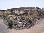
Kafra, Baysan
Arab villages depopulated during the 1948 Arab–Israeli WarPages with non-numeric formatnum arguments

Kafra (Arabic: كفرة), was a Palestinian Arab village located 10.5 kilometres north of Baysan. Built along both sides of the Wadi Kafra, the village had been known by this name since at least the time of the Crusades. It was depopulated by the Israel Defense Forces during the 1948 Palestine War on May 16, 1948.
Excerpt from the Wikipedia article Kafra, Baysan (License: CC BY-SA 3.0, Authors, Images).Kafra, Baysan
Gilboa Regional Council
Geographical coordinates (GPS) Address Nearby Places Show on map
Geographical coordinates (GPS)
| Latitude | Longitude |
|---|---|
| N 32.593055555556 ° | E 35.490833333333 ° |
Address
מועצה אזורית גלבוע
Gilboa Regional Council
North District, Israel
Open on Google Maps


