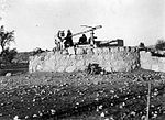
Yubla
Arab villages depopulated during the 1948 Arab–Israeli WarDistrict of BaysanPages with non-numeric formatnum arguments

Yubla (Arabic: يبلى, known to the Crusaders as Hubeleth), was a Palestinian village, located 9 kilometers north of Bisan in present-day Israel. It was depopulated during the 1948 Arab-Israeli war.
Excerpt from the Wikipedia article Yubla (License: CC BY-SA 3.0, Authors, Images).Yubla
דרך הבזלת, Gilboa Regional Council
Geographical coordinates (GPS) Address Nearby Places Show on map
Geographical coordinates (GPS)
| Latitude | Longitude |
|---|---|
| N 32.576666666667 ° | E 35.469444444444 ° |
Address
עין יובלה
דרך הבזלת
Gilboa Regional Council
North District, Israel
Open on Google Maps


