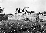
Kawkab al-Hawa
Arab villages depopulated during the 1948 Arab–Israeli WarDistrict of BaysanPages with non-numeric formatnum arguments

Kawkab al-Hawa (Arabic: كوكب الهوا), is a depopulated former Palestinian village located 11 km north of Baysan. It was built within the ruins of the Crusader fortress of Belvoir, from which it expanded. The Crusader names for the Frankish settlement at Kawkab al-Hawa were Beauvoir, Belvoir, Bellum videre, Coquet, Cuschet and Coket. During Operation Gideon in 1948, the village was occupied by the Golani Brigade and depopulated.
Excerpt from the Wikipedia article Kawkab al-Hawa (License: CC BY-SA 3.0, Authors, Images).Kawkab al-Hawa
717, Emek HaMaayanot Regional Council
Geographical coordinates (GPS) Address Nearby Places Show on map
Geographical coordinates (GPS)
| Latitude | Longitude |
|---|---|
| N 32.595277777778 ° | E 35.52 ° |
Address
717
1515700 Emek HaMaayanot Regional Council
North District, Israel
Open on Google Maps


