St Andrew's Street, Cambridge
Christ's College, CambridgeEmmanuel College, CambridgeShopping streets in CambridgeShops in CambridgeStreets in Cambridge ... and 1 more
Use British English from January 2018

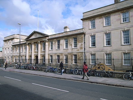
St Andrew's Street is a major street in central Cambridge, England. It runs between Sidney Street, at the junction with Hobson Street, to the northwest and Regent Street to the southeast. Downing Street leads off to the west. On the northeastern side of the street are the University of Cambridge colleges Christ's College and Emmanuel College. On the southwestern side are St Andrew the Great church and St Andrew's Street Baptist Church.
Excerpt from the Wikipedia article St Andrew's Street, Cambridge (License: CC BY-SA 3.0, Authors, Images).St Andrew's Street, Cambridge
Saint Andrew's Street, Cambridge Petersfield
Geographical coordinates (GPS) Address Website Nearby Places Show on map
Geographical coordinates (GPS)
| Latitude | Longitude |
|---|---|
| N 52.2031 ° | E 0.1239 ° |
Address
The Regal
Saint Andrew's Street 38-39
CB2 3AR Cambridge, Petersfield
England, United Kingdom
Open on Google Maps


