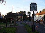
Holt Pound
Holt Pound is a hamlet on the A325 road and two side roads and forms a slight projection of the county borders into Surrey in the East Hampshire district of Hampshire, England. It is between Bordon several miles south and Farnham, which is beyond a strip of its nearest village, Rowledge, which remains its ecclesiastical parish in Surrey and Wrecclesham which touches the town. The village is between the Alice Holt Forest and fields known jointly as Old Kiln Farm and the Holt Pound Enclosure. Holt Pound has a large 20th-century pub-restaurant beside a recreation ground which is known as Holt Pound Oval. The Oval is a former a cricket ground, now registered as a village green. It was established in the 1780s until just after World War I, and was sometimes used by Surrey county teams for top-class matches.
Excerpt from the Wikipedia article Holt Pound (License: CC BY-SA 3.0, Authors).Holt Pound
Fullers Road, East Hampshire
Geographical coordinates (GPS) Address Nearby Places Show on map
Geographical coordinates (GPS)
| Latitude | Longitude |
|---|---|
| N 51.1858 ° | E -0.8343 ° |
Address
Fullers Road
Fullers Road
GU10 4LB East Hampshire
England, United Kingdom
Open on Google Maps


