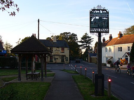
Rowledge
Borough of WaverleyEngvarB from July 2016Villages in Surrey

Rowledge is a village in England on the Surrey–Hampshire border, centred south of the A31 and Farnham. Neighbouring villages include Wrecclesham, Spreakley and Frensham. To the south west of the village is the Alice Holt Forest; to the west is Birdworld. It is in the Waverley Ward of Farnham, Wrecclesham and Rowledge.
Excerpt from the Wikipedia article Rowledge (License: CC BY-SA 3.0, Authors, Images).Rowledge
Cherry Tree Road, Waverley
Geographical coordinates (GPS) Address Nearby Places Show on map
Geographical coordinates (GPS)
| Latitude | Longitude |
|---|---|
| N 51.1822 ° | E -0.8241 ° |
Address
Cherry Tree Road
Cherry Tree Road
GU10 4AA Waverley
England, United Kingdom
Open on Google Maps


