place

Frieston

Lincolnshire geography stubsSouth Kesteven DistrictUse British English from October 2014Villages in Lincolnshire
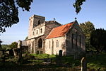
Frieston Heath Lane geograph.org.uk 281545

Frieston is a village in the South Kesteven district of Lincolnshire, England. It is situated just west of the A607 road, and 7 miles (11 km) north from the market town of Grantham. Frieston is conjoined to the southern part of the village of Caythorpe. Frieston lies within Caythorpe civil parish. Local government has been arranged in this way since the reorganisation of 1 April 1974, which resulted from the 1972 Local Government Act. Hitherto, the parish had formed part of the Parts of Kesteven. Kesteven was one of the three divisions (formally known as parts) of the traditional county of Lincolnshire. Since the 1888 Local Government Act Kesteven had been, in most respects, a county in itself. This seems to be an example of the migration of a village. 'Frieston' is a name which belongs to the 5th-century settlement of Britain by Anglo-Saxons, in this area mainly Angles, but in this case Frisians. The thorpe element of Caythorpe indicates a secondary settlement by Vikings, in this case probably Danes, at some time between 800 and 1050.

Excerpt from the Wikipedia article Frieston (License: CC BY-SA 3.0, Authors, Images).

Frieston
Hough Road, South Kesteven Caythorpe

Geographical coordinates (GPS) Address Nearby Places
placeShow on map

Wikipedia: FriestonContinue reading on Wikipedia

Geographical coordinates (GPS)

Latitude Longitude
N 53.017769 ° E -0.602991 °
placeShow on map

Address

Hough Road

Hough Road
NG32 3BZ South Kesteven, Caythorpe
England, United Kingdom
mapOpen on Google Maps

Frieston Heath Lane geograph.org.uk 281545
Share experience

Nearby Places

Caythorpe, Lincolnshire

Caythorpe is a village and civil parish in the South Kesteven district of Lincolnshire, England. The population at 2011 census was 1,374. It is situated on the A607, approximately 3 miles (5 km) south from Leadenham and 9 miles (14 km) north from Grantham. Caythorpe Heath stretches east of the village to Ermine Street and Byards Leap. Arnhem Heritage: Caythorpe is known for the soldiers based in the village during the Second World War. The 1st Airborne Signals Regiment took part in Operation Market Garden and fought for the bridges of Arnhem against the Nazis. Survivors of the Battle of Arnhem return to the village every late summer with the 216 Signals Regiment for Arnhem Weekend. There is a church service held in Saint Vincents Church, a Gala, parade through the village of the veterans and soldiers and other events in the village. The Paratroopers HQ was Holy Cross House to the south of the village which no longer stands (which was known to be haunted by ‘the grey lady’), now there is a small housing estate. There is a stained glass window memorial in Saint Vincents Church. Anglo-Saxon and Norman History: Before the Norman Conquest, Aelric (son of Mergeat) was the lord of the parish. After the Conquest of England by William the Conqueror the lord (as recorded in the 1086 Domesday Book) was Robert de Vessey. He was most likely rewarded with land by King William I after the invasion as he didn't own land prior. The Domesday Book noted that Caythorpe was in the hundred of Lovden and had a population of 172 (top 20% of settlements recorded).