Southery
Civil parishes in NorfolkKing's Lynn and West NorfolkNorfolk geography stubsVillages in Norfolk

Southery is a village and civil parish in Norfolk, England, which covers an area of 18.12 km2 (7.00 sq mi) and had a population of 1,324 at the 2011 Census. For local government purposes, it falls within the district of King's Lynn and West Norfolk. The village's name means 'southerly island'.
Excerpt from the Wikipedia article Southery (License: CC BY-SA 3.0, Authors, Images).Southery
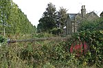
Upgate Street, King's Lynn and West Norfolk Southery
Geographical coordinates (GPS) Address Nearby Places Show on map
Geographical coordinates (GPS)
| Latitude | Longitude |
|---|---|
| N 52.5258 ° | E 0.3883 ° |
Address
Southery Hair Studio
Upgate Street 16
PE38 0NA King's Lynn and West Norfolk, Southery
England, United Kingdom
Open on Google Maps


