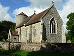
Kirstead
Civil parishes in NorfolkSouth Norfolk

Kirstead is a civil parish in the English county of Norfolk. The main settlement is Kirstead Green. The parish covers an area of 4.19 km2 (1.62 sq mi) and had a population of 247 in 89 households at the 2001 census, the population increasing to 279 at the 2011 census. For the purposes of local government, it falls within the district of South Norfolk. In 1870-72, Kirstead was described by John Marius Wilson such as:Kirstead, a village and a parish in Loddon district, Norfolk. The village stands 4+1⁄4 miles W of Loddon, and 5+1⁄2 ESE of Swainsthorpe r. station; and has a postoffice under Norwich.
Excerpt from the Wikipedia article Kirstead (License: CC BY-SA 3.0, Authors, Images).Kirstead
Zig Zag Lane, South Norfolk Kirstead
Geographical coordinates (GPS) Address Nearby Places Show on map
Geographical coordinates (GPS)
| Latitude | Longitude |
|---|---|
| N 52.52649 ° | E 1.3869 ° |
Address
Zig Zag Lane
Zig Zag Lane
NR15 1ER South Norfolk, Kirstead
England, United Kingdom
Open on Google Maps


