Zona Franca (Barcelona)

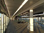
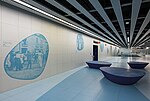
Zona Franca (Catalan pronunciation: [ˈzonə ˈfɾaŋkə], also called in Catalan: Polígon Industrial de la Zona Franca) is a logistics and industrial area located in the Sants-Montjuïc district of Barcelona, Catalonia, Spain. Together with the adjacent Port of Barcelona it forms the neighborhood Zona Franca – Port. It is located in the Llobregat Delta between the Port of Barcelona and Barcelona Airport. The metro line L10 connects Zona Franca with central Barcelona and the rest of the metropolitan area since 2018. The origins and the name of the area date back to an attempt to create a free port in Barcelona which ultimately failed in 1929. With Catalonia's industrialisation in the 1950s the space was used to construct factories.
Excerpt from the Wikipedia article Zona Franca (Barcelona) (License: CC BY-SA 3.0, Authors, Images).Zona Franca (Barcelona)
Barcelona
Geographical coordinates (GPS) Address Nearby Places Show on map
Geographical coordinates (GPS)
| Latitude | Longitude |
|---|---|
| N 41.333333333333 ° | E 2.1386111111111 ° |
Address
08001 Barcelona
Catalonia, Spain
Open on Google Maps


