place

Fernhurst

Chichester DistrictEngvarB from June 2016Villages in West Sussex
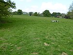
Fernhurst Green
Fernhurst Green

Fernhurst is a village and civil parish in the Chichester District of West Sussex, England, on the A286 Milford, Surrey, to Chichester road, 3 miles (4.8 km) south of Haslemere. The parish includes the settlements of Henley Common, Kingsley Green and Bell Vale, lies within the boundaries of the South Downs National Park and is surrounded by hills. The area of the parish is 5,772 acres (2,336 ha). In the 2001 census there were 1,158 households with a total population of 2,765 of whom 1,244 were economically active. The population had increased to 2,942 at the 2011 Census.

Excerpt from the Wikipedia article Fernhurst (License: CC BY-SA 3.0, Authors, Images).

Fernhurst
Cherrylands Close, Chichester

Geographical coordinates (GPS) Address Nearby Places
placeShow on map

Wikipedia: FernhurstContinue reading on Wikipedia

Geographical coordinates (GPS)

Latitude Longitude
N 51.049 ° E -0.723 °
placeShow on map

Address

Cherrylands Close

Cherrylands Close
GU27 3PH Chichester
England, United Kingdom
mapOpen on Google Maps

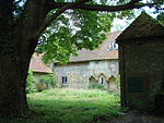
Fernhurst Green
Fernhurst Green
Share experience

Nearby Places

Western Weald

The western Weald is an area of undulating countryside in Hampshire and West Sussex containing a mixture of woodland and heathland areas. It lies to the south of the towns of Bordon, Haslemere and Rake and to the west of the town of Pulborough. It includes the towns of Liss and Petersfield on its western boundary and the towns of Midhurst and Petworth to the south. Natural features include Blackdown, the highest point in Sussex, and Woolmer Forest in Hampshire. The chalk escarpment of the South Downs forms a prominent boundary to the south and west. The western Weald forms part of the larger Weald. Geologically it consists of a mixture of sandstone and clay strata which have been exposed by the erosion of the Weald-Artois Anticline. The resulting soils include acid heathland and poorly draining clay soil which support deciduous, particularly oak, woodlands interspersed with small irregularly shaped fields, with many surviving medieval boundaries. The western Weald came to prominence as the result of a protracted and sometimes heated dispute about whether or not the area should be included in the South Downs National Park. The original public inquiry into the proposal to create the national park concluded that it should be excluded, in large part because of its different geology from the chalky South Downs. However, following a second inquiry the government decided that the whole of the western Weald should be included, a decision which took effect when the new national park formally came into existence on 31 March 2010.