place

Haste Hill

HaslemereHills of SurreySurrey geography stubsUse British English from May 2015

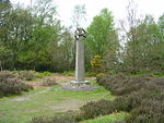
Haste Hill is a hill near Haslemere, Surrey in England which was probably the original settlement of the town of Haslemere. It was used as the site of a semaphore station in the nineteenth century. Haste Hill is south-east of the present town of Haslemere and consists of 24 acres (97,000 m2) of mixed woodland with a pond and has a viewpoint looking over the Weald to the northeast. In the 14th century, Haste Hill, also called East Hill, was the main settlement at Haslemere and there may have been a church as there were references on the site to "Churchliten field" and the "Old church-yard" of Haslemere.An Admiralty Telegraph Station was built on Haste Hill in 1821 on part of some enclosures called Jackman's Fields. The building was of a bungalow style with the semaphore above the operating room and it was part of the semaphore line from London to Portsmouth from 1822 to 1847. The Admiralty sold the site in 1849 after the line closed, and the building underwent various additions and alterations. It is now the Whitwell Hatch Hotel.The admiralty returned to the site during World War II when by the end of May 1941, the Royal Naval Signals School set up its production department at Whitwell Hatch Hotel. The site was commissioned as part of HMS Mercury on 25 August 1941.

Excerpt from the Wikipedia article Haste Hill (License: CC BY-SA 3.0, Authors).

Haste Hill
Blackdown Lane, Waverley

Geographical coordinates (GPS) Address Nearby Places
placeShow on map

Wikipedia: Haste HillContinue reading on Wikipedia

Geographical coordinates (GPS)

Latitude Longitude
N 51.0822 ° E -0.7012 °
placeShow on map

Address

Blackdown Lane

Blackdown Lane
GU27 3AZ Waverley
England, United Kingdom
mapOpen on Google Maps

Share experience

Nearby Places

Haslemere
Haslemere

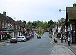
The town of Haslemere () and the villages of Shottermill and Grayswood are in south west Surrey, England, around 38 mi (62 km) south west of London. Together with the settlements of Hindhead and Beacon Hill, they comprise the civil parish of Haslemere in the Borough of Waverley. The tripoint between the counties of Surrey, Hampshire and West Sussex is at the west end of Shottermill. Much of the civil parish is in the catchment area of the south branch of the River Wey, which rises on Blackdown in West Sussex. The urban areas of Haslemere and Shottermill are concentrated along the valleys of the young river and its tributaries, and many of the local roads are narrow and steep. The National Trust is a major landowner in the civil parish and its properties include Swan Barn Farm. The Surrey Hills Area of Outstanding Natural Beauty is to the north of the town and the South Downs National Park is to the south. Haslemere is thought to have originated as a planned town in the 12th century and was awarded a market charter in 1221. By the early 16th century, it had become a Parliamentary borough and was represented by two MPs in the House of Commons until 1832. The town began to grow in the second half of the 19th century, following the opening of the London to Portsmouth railway line in 1859. In late-Victorian times, it became a centre for the Arts and Crafts movement and the International Dolmetsch Early Music Festival was founded in 1925. Haslemere became an Urban District in 1913, but under the Local Government Act 1972, its status was reduced to a civil parish with a town council. Shottermill grew up as a hamlet near to one of the watermills on the River Wey in the 16th century. The settlement began to expand in the 1880s and joined the Haslemere Urban District in 1933. Until the end of the 19th century, Grayswood was a small farming community, but became an ecclesiastical parish in 1901.