place

Burgh Windmill

Grade II listed buildings in SuffolkGrade II listed windmillsGrinding mills in the United KingdomSuffolk CoastalTower mills in the United Kingdom
Windmills completed in 1842Windmills in Suffolk
Burgh Mill, Suffolk 2005

Burgh Mill is a Grade II listed tower mill at Burgh, Suffolk, England which has been converted to residential accommodation.

Excerpt from the Wikipedia article Burgh Windmill (License: CC BY-SA 3.0, Authors, Images).

Burgh Windmill
Mill Hill, East Suffolk

Geographical coordinates (GPS) Address Nearby Places
placeShow on map

Wikipedia: Burgh WindmillContinue reading on Wikipedia

Geographical coordinates (GPS)

Latitude Longitude
N 52.115833333333 ° E 1.2580555555556 °
placeShow on map

Address

Mill Hill

Mill Hill
IP13 6PX East Suffolk
England, United Kingdom
mapOpen on Google Maps

Burgh Mill, Suffolk 2005
Share experience

Nearby Places

Burgh, Suffolk
Burgh, Suffolk

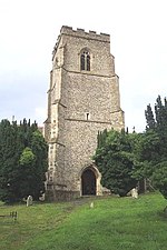
Burgh () is a village and civil parish in the East Suffolk district of Suffolk, England, about 3.5 miles (6 km) north-west of Woodbridge.St Botolph's church stands within a ploughed-flat iron-age enclosure - the "burgh" - near the site of a possible Roman villa that stretches towards Clopton churchyard. The enclosure has been excavated, and found to date between 50 BC to 60 AD. Roman finds were also made, including some military items, and fragments of what may have been a hypocaust.The body of Saint Botolph (or Botwulf) is supposed to have been buried at his foundation of Icanho (Iken) but in 970, Edgar I of England gave permission for Botolph's remains to be transferred to a place "near Grundisburgh". It is thought that probably Burgh is meant. They remained for some fifty years before being transferred to their own tomb at Bury St Edmunds Abbey, on the instructions of Cnut. There was a church in the burgh in the middle Saxon period. The present church building dates from the 14th century and is a Grade II* listed building. In the north wall is a mural painting by Anna Zinkeisen in memory of her husband Col. Guy Heseltine of c. 1967 showing birds of the Bible. The population of Burgh is about 200, measured at 182 at the 2011 census. Because of its small size, there is no parish council, and no parish rate is levied. Instead, there is a parish meeting to which all villagers are invited. This meeting occurs two or three times a year. During these meetings, residents are welcome to discuss the issues, problems, concerns and affairs of the village. Several artists and craftsmen live and work in the village. The neighbouring village of Grundisburgh and the towns of Woodbridge and Ipswich provide shops and all business and commercial services.

Bealings railway station

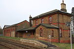
Bealings railway station was a station in Little Bealings, Suffolk, on the line between Ipswich and Lowestoft. It was 7 miles 20 chains (11.7 km) down the line from Ipswich. While the station closed on 17 September 1956, the line remains open and both the station building and platforms survive. It was opened by the Eastern Union Railway (EUR) on 1 June 1859 when the full East Suffolk Line opened between Great Yarmouth in Norfolk and Ipswich in Suffolk. The station buildings were designed by Frederick Barnes (architect), who also designed Woodbridge station. By the 1860s the railways in East Anglia were in financial trouble, and most (including the EUR) were leased to the Eastern Counties Railway; they wished to amalgamate formally, but could not obtain government agreement for this until 1862, when the Great Eastern Railway was formed by amalgamation. Thus in 1862 the operation of Bealings Station was taken over by the Great Eastern Railway who operated the station until 1923 when grouping saw the Great Eastern Railway taken over by the London and North Eastern Railway. The July 1922 Bradshaw's Guide showed seven up services (towards Ipswich) and seven down services calling at the station, with two services each way on Sundays. Most services were local trains which would originate or terminate at Ipswich and call at most stations on the East Suffolk Line. However, the station did enjoy a main line service direct to Liverpool Street. Bradshaw's stated that the 08:17 departure conveyed first and third class Pullman carriages (there was no second class at this time), arriving in Liverpool Street at 10:30. The return working was at 15:18, arriving back in Bealings at 17:22. From 1916 the station was the railhead for Martlesham Heath Airfield. In 1919 the goods yard was recorded as having three roads one of which served a small goods shed (the building on the left-hand side of the picture).After World War II the railways were nationalised and Bealings station became part of British Railways' Eastern Region. Lack of patronage saw the station close in September 1956 and the goods yard followed in April 1965. The signal box (opened in 1884 with 18 levers for signals and points) remained in use, however, as a block post to divide up the Westerfield-Woodbridge section and to operate the level crossing gates. The box lasted until 1984, when it was closed as a result of the introduction of RETB (Radio Electronic Token Block) signalling on the East Suffolk line; at the same time, the manual level crossing gates were replaced by the current automatic half-barriers. The station building is still extant today and is occupied by the Mallard Business Centre.