Mount Pleasant, Providence, Rhode Island

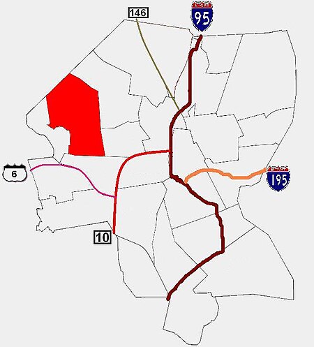
Mount Pleasant is a working-class residential neighborhood situated in the northwest of the city of Providence, Rhode Island. It is bordered by Olneyville to the south, Valley to the east, Manton to the west, and Elmhurst to the northeast, and the Town of North Providence to the north. The major street boundaries that define Mount Pleasant are Academy Avenue to the east, Smith Street to the northeast, Atwells Avenue to the south, and portions of Bullock, Chalkstone, Mera, and Rushmore Avenues to the west. Mount Pleasant is one of Providence's most stable neighborhoods. According to the 1990 census, less than half of all Mount Pleasant residents moved into their current residence in the past five years; nearly four out of ten residents had lived in their present unit for more than a decade, and almost one out of five had lived in his or her current home for more than 20 years.
Excerpt from the Wikipedia article Mount Pleasant, Providence, Rhode Island (License: CC BY-SA 3.0, Authors, Images).Mount Pleasant, Providence, Rhode Island
Standish Avenue, Providence
Geographical coordinates (GPS) Address Nearby Places Show on map
Geographical coordinates (GPS)
| Latitude | Longitude |
|---|---|
| N 41.837 ° | E -71.454 ° |
Address
Standish Avenue
02908 Providence
Rhode Island, United States
Open on Google Maps


