Razor Hill
Hong Kong mountain stubsMountains, peaks and hills of Hong KongSai Kung DistrictTai Po TsaiTseung Kwan O
_from_Autau,_Tsenglanshue.jpg)
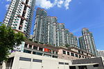
Razor Hill, also locally known as Che Kwu Shan (Chinese: 鷓鴣山), is a hill between Pik Uk, Ta Ku Ling, Tseung Kwan O, and Tai Po Tsai in the New Territories of Hong Kong. It is 432 metres tall. The north and east mid slopes are skirted by Clear Water Bay Road.
Excerpt from the Wikipedia article Razor Hill (License: CC BY-SA 3.0, Authors, Images).Razor Hill
Po Hang Path, Sai Kung District
Geographical coordinates (GPS) Address Nearby Places Show on map
 Continue reading on Wikipedia
 Geographical coordinates (GPS)
| Latitude | Longitude |
|---|---|
| N 22.330861111111 ° | E 114.25351111111 ° |
Address
Po Hang Path
Sai Kung District
Hong Kong, China
Open on Google Maps