Olneyville, Providence, Rhode Island
Ethnic enclaves in Rhode IslandHispanic and Latino American culture in Providence, Rhode IslandNeighborhoods in Providence, Rhode Island

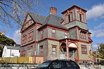
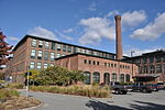
Olneyville is a neighborhood in Providence, Rhode Island bordered by Atwells Avenue to the north, U.S. Route 6 to the south and Rhode Island Route 10 to the east. The Woonasquatucket River runs through the southern portion of the neighborhood. The area is roughly triangular. Olneyville Square is a major traffic intersection in Olneyville, defined by the intersection of Westminster Street, Broadway, Hartford Ave, Plainfield Street, and Manton Avenue.
Excerpt from the Wikipedia article Olneyville, Providence, Rhode Island (License: CC BY-SA 3.0, Authors, Images).Olneyville, Providence, Rhode Island
Florence Street, Providence
Geographical coordinates (GPS) Address Nearby Places Show on map
Geographical coordinates (GPS)
| Latitude | Longitude |
|---|---|
| N 41.821424 ° | E -71.445977 ° |
Address
Florence Street 54
02909 Providence
Rhode Island, United States
Open on Google Maps


