place

Six Mile Bottom railway station

Disused railway stations in CambridgeshireFormer Great Eastern Railway stationsPages with no open date in Infobox stationRailway stations in Great Britain closed in 1967Railway stations in Great Britain opened in 1848
Use British English from February 2017
TrainAt6MB
TrainAt6MB

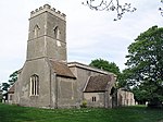
Six Mile Bottom railway station is a disused railway station on the Ipswich to Cambridge line between Dullingham and Fulbourn. It served the village of Six Mile Bottom, until closure in January 1967. The station buildings and one platform remain as a private residence. Although the station is closed, the line remains in use by trains between Ipswich and Cambridge.The Newmarket and Chesterford Railway opened the station in 1848 on its line which connected Newmarket and Great Chesterford. They had also commenced work on a line that would link Six Mile Bottom to Cambridge after which the company then intended to extend further with a line to Thetford which would give a more direct route to Norwich. The Eastern Counties Railway (ECR) who operated trains via Cambridge to Norwich were not happy with this and put pressure on the Newmarket Railway leading them to cease trading in June 1850. However, under the leadership of bankruptcy commissioner Cecil Fane, the company was re-established in September of the same year and instead the line from Six Mile Bottom to Cambridge was completed using the track from the Chesterford – Six Mile Bottom section. This line then opened on 9 October 1851 and the Chesterford route was closed.

Excerpt from the Wikipedia article Six Mile Bottom railway station (License: CC BY-SA 3.0, Authors, Images).

Six Mile Bottom railway station
A1304,

Geographical coordinates (GPS) Address Nearby Places
placeShow on map

Wikipedia: Six Mile Bottom railway stationContinue reading on Wikipedia

Geographical coordinates (GPS)

Latitude Longitude
N 52.1862 ° E 0.3052 °
placeShow on map

Address

A1304
CB8 0UJ , Little Wilbraham (South Cambridgeshire)
England, United Kingdom
mapOpen on Google Maps

TrainAt6MB
TrainAt6MB
Share experience

Nearby Places

Cambridgeshire Lodes

The Cambridgeshire Lodes are a series of man-made waterways, believed to be Roman in origin, located in the county of Cambridgeshire, England. Bottisham, Swaffham Bulbeck, Reach, Burwell, Wicken and Monks Lodes all connect to the River Cam, while Soham Lode connects to the River Great Ouse. All have been navigable historically, but some are no longer officially navigable. Bottisham Lode was navigated throughout the 19th century, and although the flood gates at its mouth were replaced in 2001, it carries a "No unauthorised vessels" notice. Swaffham Bulbeck Lode has been rendered unnavigable by the removal of the lower lock gates, and the replacement of the upper lock gates with a guillotine gate which provides little headroom. Reach Lode is quite deep, as a result of the surrounding land sinking, and the banks being built up. The lower gate of the entrance lock has been replaced by a guillotine gate, enabling boats up to 63 feet (19 m) long to use it. Burwell Lode is a tributary of Reach Lode, and is another deep lode. Barges were built and maintainted at Burwell until 1936, and it was used commercially until 1963, when carriage of sugar beet ceased. Wicken Lode is another tributary of Reach Lode, and was important for the carriage of peat and sedge. It runs through Wicken Fen, one of the oldest nature reserves in England, as the National Trust bought their first part of it in 1899. Soham Lode is more recent than most, probably dating from the 1790s. It ran by Soham Mere, a large inland lake which was drained in the late 18th century. In 2007 a strategy plan considered options for the management of the lodes which included rebuilding most of them at a lower level, but concluded that maintaining the banks at the existing level was a better long-term solution.