Steeles Tavern, Virginia
Augusta County, Virginia geography stubsRockbridge County, Virginia geography stubsUnincorporated communities in Augusta County, VirginiaUnincorporated communities in Rockbridge County, VirginiaUnincorporated communities in Virginia ... and 1 more
Use mdy dates from July 2023

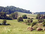
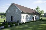
Steeles Tavern (formerly Midway) is an unincorporated community in Augusta County and Rockbridge County, Virginia. It lies at an elevation of 1683 feet (513 m). The Cyrus McCormick Farm was listed on the National Register of Historic Places in 1966.
Excerpt from the Wikipedia article Steeles Tavern, Virginia (License: CC BY-SA 3.0, Authors, Images).Steeles Tavern, Virginia
Lee Jackson Highway,
Geographical coordinates (GPS) Address Nearby Places Show on map
Geographical coordinates (GPS)
| Latitude | Longitude |
|---|---|
| N 37.925555555556 ° | E -79.2025 ° |
Address
Lee Jackson Highway 6548
24472
Virginia, United States
Open on Google Maps


