Stotfold
All pages needing cleanupCentral Bedfordshire DistrictCivil parishes in BedfordshireStotfoldTowns in Bedfordshire ... and 1 more
Use British English from July 2016

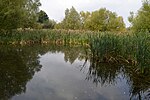
Stotfold is a town and civil parish in the Central Bedfordshire borough of Bedfordshire, England. The town covers 2,207 acres (8.93 km2) and the River Ivel passes through the town. The population at the 2011 census was 9,632. Stotfold is close to the county border with Hertfordshire.
Excerpt from the Wikipedia article Stotfold (License: CC BY-SA 3.0, Authors, Images).Stotfold
Mowbray Crescent,
Geographical coordinates (GPS) Address Nearby Places Show on map
Geographical coordinates (GPS)
| Latitude | Longitude |
|---|---|
| N 52.018 ° | E -0.228 ° |
Address
Mowbray Crescent
Mowbray Crescent
SG5 4DS , Stotfold
England, United Kingdom
Open on Google Maps


