place

Stotfold Mill Meadows

Local Nature Reserves in BedfordshireMeadows in BedfordshireStotfold
Stotfold Mill Meadows 7

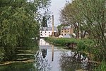
Stotfold Mill Meadows is a 3.4 hectare Local Nature Reserve (LNR) in Stotfold in Bedfordshire. It was declared an LNR by Central Bedfordshire Council in 2010, and is managed by the Stotfold Mill Preservation Trust, which also runs the neighbouring Stotfold Watermill.The meadows are on the east bank of the River Ivel, and have water birds and invertebrates such as frogs, toads and newts. The site also has meadows with a number of ponds, and an area of woodland.There is access from Mill Lane.

Excerpt from the Wikipedia article Stotfold Mill Meadows (License: CC BY-SA 3.0, Authors, Images).

Stotfold Mill Meadows
Prince Charles Avenue,

Geographical coordinates (GPS) Address Website Nearby Places
placeShow on map

Wikipedia: Stotfold Mill MeadowsContinue reading on Wikipedia

Geographical coordinates (GPS)

Latitude Longitude
N 52.014775 ° E -0.217135 °
placeShow on map

Address

Stotfold Watermill Nature Reserve

Prince Charles Avenue
SG5 4PN , Stotfold
England, United Kingdom
mapOpen on Google Maps

Website
stotfoldmill.com

linkVisit website

Stotfold Mill Meadows 7
Share experience

Nearby Places

Caldecote, Hertfordshire

Caldecote is a village and civil parish in the North Hertfordshire district of Hertfordshire, England. It is located around three miles north of Baldock and around a mile and a half east of Stotfold in the neighbouring county of Bedfordshire. The Great North Road passes just to the west of the village. Caldecote forms part of the Caldecote and Newnham grouped parish council, which covers an area of only 325 acres (1.32 km2). The village consists of a cluster of cottages around the redundant Church of St. Mary Magdalene, which dates from the 14th and 15th centuries and is in Perpendicular style. The church is currently in the care of the Friends of Friendless Churches charity.To the south of the church is a manor house dating from the 14th century. In the year 1724, several Roman urns, containing burnt bones and ashes, were discovered in this parish. During the 1970s archaeological excavations were carried out for a number of summers under the direction of Professor Guy Beresford. These revealed that during the 12th and 13th centuries there were approximately nine crofts lying to the north of the church and possibly three others close to the northwest boundary of the present manor garden. The population declined heavily during the mid-14th century, mainly due to the Black Death; no subsidy was paid in 1428 indicating that by then there were less than ten householders. The excavations demonstrated that after the manor was granted to the Priory the lands of the peasantry were gradually amalgamated.