South Luffenham

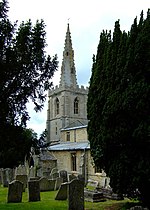
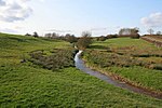
South Luffenham is a village in the county of Rutland in the East Midlands of England. The population of the civil parish was 470 in 2021 increasing from 455 at the 2011 census.The village lies largely on the north side of the A6121 road from Uppingham to Stamford. It is divided into two by a small stream, the Foss, which is a tributary of the River Chater. The village has two pubs, the Boot Inn (formerly the Boot and Shoe) and the Coach House (previously the Halfway House), as well as the parish church and the village hall. South Luffenham Hall stands a short distance to the south-east of St Mary's church. There is a ruined windmill to the east of the village. Luffenham railway station was located to the north of the village and also served the neighbouring village of North Luffenham. The railway station opened in 1848 and closed in 1966. In fact, there were two railway stations in the parish, since Morcott station lay just within the South Luffenham parish boundary.
Excerpt from the Wikipedia article South Luffenham (License: CC BY-SA 3.0, Authors, Images).South Luffenham
The Street,
Geographical coordinates (GPS) Address Nearby Places Show on map
Geographical coordinates (GPS)
| Latitude | Longitude |
|---|---|
| N 52.607 ° | E -0.611 ° |
Address
The Street
LE15 8NR
England, United Kingdom
Open on Google Maps


