Saddington

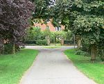
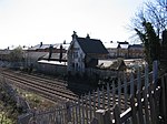
Saddington is a village in the Harborough district of Leicestershire, England. It is close to Smeeton Westerby, Gumley, Kibworth and Fleckney. The population of the civil parish at the 2011 census was 309.It is a small hilltop village close to and south of Fleckney. It overlooks the Saddington Reservoir, constructed in 1802 to feed the Grand Union Canal. The canal flows through the parish including in a tunnel of 0.5 miles (0.80 km). The church of St Helen in medieval style largely dates from 1872–73 and retains an original 13th century north doorway and other masonry of around 1300 and around 1400.The Saddington Treacle Mine is a notable fictional local attraction, often referred to by locals of the surrounding villages. Saddington is also home to the Manor Farm Riding School along the main street next to the church of St Helen.
Excerpt from the Wikipedia article Saddington (License: CC BY-SA 3.0, Authors, Images).Saddington
Weir Road, Harborough Saddington
Geographical coordinates (GPS) Address Nearby Places Show on map
Geographical coordinates (GPS)
| Latitude | Longitude |
|---|---|
| N 52.516666666667 ° | E -1.0333333333333 ° |
Address
Weir Road
Weir Road
LE8 0QH Harborough, Saddington
England, United Kingdom
Open on Google Maps


