place

Antietam Iron Furnace Site and Antietam Village

Archaeological sites on the National Register of Historic Places in MarylandHistoric districts in Washington County, MarylandHistoric districts on the National Register of Historic Places in MarylandNRHP infobox with nocatNational Register of Historic Places in Washington County, Maryland
Use mdy dates from August 2023Washington County, Maryland Registered Historic Place stubs
Antietam Aqueduct at Antietam Iron Furnace Site and Antietam Village

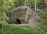
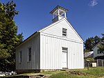
Antietam Iron Furnace Site and Antietam Village is a national historic district at Antietam, Washington County, Maryland, United States. It consists of the remains of a mid-18th to late-19th century iron furnace site, and the nearby related village. Remnants of the ironworks include a dam and race, a possible wheel pit or building foundation, the possible location of a furnace stack, and a four-arch stone bridge built by John Weaver in 1832. Also at the site are the dozen or so brick, stone, and wood houses comprising Antietam Village. Typical of the houses is the Mentzer house, a four-bay, two-storey stone structure of roughly coursed fieldstone, painted white.The district was added to the National Register of Historic Places in 1975.

Excerpt from the Wikipedia article Antietam Iron Furnace Site and Antietam Village (License: CC BY-SA 3.0, Authors, Images).

Antietam Iron Furnace Site and Antietam Village
Harpers Ferry Road,

Geographical coordinates (GPS) Address Nearby Places
placeShow on map

Wikipedia: Antietam Iron Furnace Site and Antietam VillageContinue reading on Wikipedia

Geographical coordinates (GPS)

Latitude Longitude
N 39.416944444444 ° E -77.7425 °
placeShow on map

Address

Harpers Ferry Road 3818
21782
Maryland, United States
mapOpen on Google Maps

Antietam Aqueduct at Antietam Iron Furnace Site and Antietam Village
Share experience

Nearby Places

Hagerstown Valley

Hagerstown Valley is located in Maryland in the United States. It is part of the Great Appalachian Valley, which continues northward as Cumberland Valley in Pennsylvania, and southward as Shenandoah Valley in West Virginia and Virginia. Hagerstown Valley is bounded on the east by South Mountain, part of the Blue Ridge Mountains. On the west the valley is bounded by the Bear Pond Mountains — a range of mountains linking Blue Mountain and North Mountain. The valley is bounded on the south by the Potomac River and on the north by the drainage divide between Conococheague Creek, which flows south to the Potomac River, and Conodoguinet Creek, which flows northeast to the Susquehanna River. Sometimes the boundary between Hagerstown Valley and Cumberland Valley is defined politically, as the state line between Maryland and Pennsylvania. The political definition restricts Hagerstown Valley to Washington County, Maryland, while the larger definition includes part of Franklin County, Pennsylvania as well. Sometimes Cumberland Valley is defined so as to include Hagerstown Valley entirely, extending south all the way to the Potomac River. Antietam Creek flows through Hagerstown Valley to the Potomac River. Antietam National Battlefield is also in the valley, where the Battle of Antietam was fought during the American Civil War. The main cities are Hagerstown, Maryland and Waynesboro, Pennsylvania. The water divide between Hagerstown and Cumberland valleys occurs near the city of Chambersburg, Pennsylvania.